Area Overview for LN2 3LY
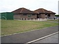
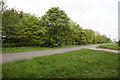
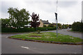
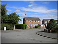
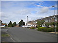
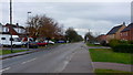
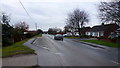
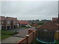
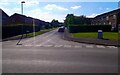
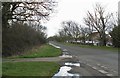
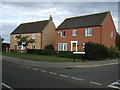
Photos of LN2 3LY

Area Information
Living in LN2 3LY offers a compact, residential experience shaped by its small footprint of 3.3 hectares and a population of nearly 2,000 people. This postcode area is a tightly knit cluster of homes, predominantly houses, catering to a mature demographic. With a median age of 47 and a majority of residents aged 30–64, the community leans towards established households. The area’s low population density of 200 people per square kilometre ensures a quiet, less congested environment. Daily life here is characterised by proximity to essential amenities, including five retail outlets and the nearby RAF Scampton, offering both local convenience and regional connectivity. The area’s safety profile is strong, with a crime risk score of 78 and no significant environmental hazards. While not a sprawling suburb, LN2 3LY provides a stable, low-maintenance lifestyle for those prioritising security and simplicity. Its small size means residents are likely to know their neighbours, fostering a sense of community in a setting that balances privacy with accessibility.
- Area Type
- Postcode
- Area Size
- 3.3 hectares
- Population
- 1978
- Population Density
- 200 people/km²
The property market in LN2 3LY is defined by its high home ownership rate of 78% and the prevalence of houses. This suggests a community where long-term residency is common, with fewer rental properties available. The area’s small size—just 3.3 hectares—means the housing stock is limited, likely consisting of a modest number of individual homes rather than larger developments. For buyers, this creates a niche market where properties may be in high demand, particularly among those seeking a quiet, low-density environment. The absence of flats or apartments implies that the area caters to those preferring single-family homes. However, the small scale of the area also means that the immediate surroundings may offer limited additional housing options. Potential buyers should consider the limited availability of properties and the possibility of a competitive market, especially for those seeking to purchase within this specific postcode.
House Prices in LN2 3LY
Showing 47 properties
| Address | Type | Beds | Baths | Last Sale Price | Last Sale Date | |
|---|---|---|---|---|---|---|
| 13 Hackthorn Road, Welton, Lincoln, LN2 3LY | Semi-detached | 3 | 1 | £222,000 | Nov 2025 | |
| 57 Hackthorn Road, Welton, Lincoln, LN2 3LY | Detached | 4 | 2 | £387,500 | Aug 2025 | |
| 26 Hackthorn Road, Welton, Lincoln, LN2 3LY | Detached | 4 | 3 | £450,000 | Mar 2023 | |
| 17 Hackthorn Road, Welton, Lincoln, LN2 3LY | Retail | 3 | 1 | £210,000 | Jul 2022 | |
| 11 Hackthorn Road, Welton, Lincoln, LN2 3LY | Detached | 4 | 2 | £155,000 | Sep 2021 | |
| 21 Hackthorn Road, Welton, Lincoln, LN2 3LY | Detached | 3 | 2 | £197,000 | Jan 2021 | |
| Firholme, 18 Hackthorn Road, Welton, Lincoln, LN2 3LY | house | - | - | £265,000 | Sep 2020 | |
| 35 Hackthorn Road, Welton, Lincoln, LN2 3LY | Semi-detached | 3 | 1 | £183,000 | Mar 2020 | |
| 2 Hackthorn Road, Welton, Lincoln, LN2 3LY | Bungalow | - | - | £270,000 | Oct 2019 | |
| 23 Hackthorn Road, Welton, Lincoln, LN2 3LY | Semi-detached | 3 | 2 | £190,000 | Oct 2019 |
Energy Efficiency in LN2 3LY
The lifestyle in LN2 3LY is shaped by its proximity to five retail outlets, including three branches of Lincolnshire Co-operative Co, providing essential shopping and services. These local stores cater to daily needs, from groceries to household items, reducing the necessity for long trips. The nearby RAF Scampton adds a layer of regional accessibility, though it is not a traditional leisure destination. The area’s small size means amenities are concentrated, creating a self-contained environment where residents can access basic services without leaving the immediate vicinity. However, the absence of dedicated parks, restaurants, or cultural venues suggests that leisure activities may be limited to nearby towns. For those prioritising convenience over variety, LN2 3LY offers a functional lifestyle with local shops and a strategic location near an airport. The compact nature of the area ensures that essentials are within practical reach, though expansion beyond the postcode may be necessary for more diverse experiences.
Amenities
Schools
| Rank | School | Type | Entry gender | Ages |
|---|
Explore more schools in this area
Go to Schools tabDemographics
The demographic profile of LN2 3LY reflects a mature, predominantly owner-occupied population. With a median age of 47 and 78% of homes owned by residents, the area is dominated by households in the 30–64 age range. This suggests a community of long-term residents, many of whom may be in their peak earning years or nearing retirement. The accommodation type is exclusively houses, which aligns with the 78% home ownership rate, indicating a lack of rental properties or flats. The predominant ethnic group is White, though no specific data on diversity or deprivation is provided. The population density of 200 people per square kilometre is relatively low, contributing to a less crowded environment. This combination of age, ownership, and housing type suggests a stable, low-turnover community where families or individuals may have established roots. The absence of detailed diversity metrics means the area’s cultural composition remains unexplored in this context.
Household Size
Accommodation Type
Tenure
Ethnic Group
Religion
Household Composition
Age
Household Deprivation
NS-SEC
Explore more demographic insights in this area
Go to Demographics tabPlanning
Planning Constraints
- Flood RiskPremium
- Ramsar Wetland SitesPremium
- Area of Outstanding Natural BeautyPremium
- Protected Nature ReservePremium
- Protected WoodlandPremium