Area Overview for LN2 3LX
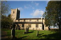
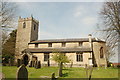
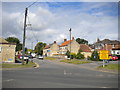
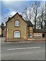
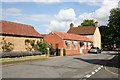
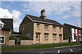
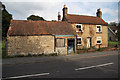
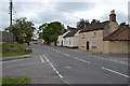
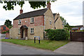
Photos of LN2 3LX


Area Information
LN2 3LX is a small, tightly packed residential cluster in England, covering just 1.1 hectares. With a population of 2,110 and a density of 199,410 people per square kilometre, this area is densely populated yet retains a distinct character. The community is predominantly composed of adults aged 30–64, with a median age of 47, suggesting a mature, stable demographic. Most residents own their homes, with 87% of properties in private ownership. The area is defined by its compact size, where daily life is shaped by proximity to essential services. Nearby, Lincoln Central Railway Station offers connections to Lincoln and beyond, while RAF Scampton provides a unique local landmark. For families, two primary schools—Welton St Mary’s Church of England Primary School and Academy—lie within practical reach. The area’s mix of residential density and accessible amenities makes it appealing for those seeking a settled, community-focused lifestyle in a small, well-served postcode.
- Area Type
- Postcode
- Area Size
- 1.1 hectares
- Population
- 2110
- Population Density
- 3219 people/km²
The property market in LN2 3LX is characterised by high home ownership, with 87% of properties in private hands. This suggests a community where long-term residency is common, and rental demand is likely lower than in more transient areas. The accommodation type is predominantly houses, which may appeal to families or individuals seeking more space. Given the area’s small size—just 1.1 hectares—the housing stock is limited, and buyers should consider proximity to surrounding areas for additional options. The compact nature of LN2 3LX means properties are likely close to amenities such as schools and transport links. However, the high population density and limited land area may restrict future development, making this a niche market for those prioritising proximity to essential services over expansive property choices.
House Prices in LN2 3LX
Showing 12 properties
| Address | Type | Beds | Baths | Last Sale Price | Last Sale Date | |
|---|---|---|---|---|---|---|
| 14 The Grove, Welton, Lincoln, LN2 3LX | Bungalow | - | - | £377,500 | Aug 2022 | |
| 2 The Grove, Welton, Lincoln, LN2 3LX | Detached | 2 | 1 | £230,000 | Jan 2022 | |
| 3 The Grove, Welton, Lincoln, LN2 3LX | Bungalow | 3 | 1 | £200,000 | Feb 2021 | |
| 8 The Grove, Welton, Lincoln, LN2 3LX | Bungalow | - | - | £230,000 | Jan 2019 | |
| 6 The Grove, Welton, Lincoln, LN2 3LX | Detached | 3 | 1 | £180,000 | Sep 2018 | |
| 1 The Grove, Welton, Lincoln, LN2 3LX | Bungalow | 3 | - | £184,950 | Jun 2013 | |
| 7 The Grove, Welton, Lincoln, LN2 3LX | Detached | 3 | 1 | £154,950 | Sep 2003 | |
| 5 The Grove, Welton, Lincoln, LN2 3LX | Semi-detached | - | - | £66,750 | Dec 1999 | |
| 4 The Grove, Welton, Lincoln, LN2 3LX | Bungalow | - | - | £68,000 | Oct 1999 | |
| 9 The Grove, Welton, Lincoln, LN2 3LX | Detached | - | - | £98,000 | Jan 1997 |
Energy Efficiency in LN2 3LX
Daily life in LN2 3LX is shaped by its proximity to essential amenities. The area has five retail outlets, including three branches of Lincolnshire Co-operative Co, providing basic shopping needs within reach. Lincoln Central Railway Station offers access to Lincoln’s broader retail and leisure options, while RAF Scampton adds a unique local presence. The small size of the area means amenities are closely clustered, though the retail options are limited to local cooperatives and nearby stations. For leisure, the absence of parks or recreational facilities is notable, but the nearby railway station and airport may offer alternative activities. The community’s character is defined by its compactness, with residents likely relying on nearby towns for more extensive amenities.
Amenities
Schools
Residents of LN2 3LX have access to two primary schools: Welton St Mary’s Church of England Primary School and Welton St Mary’s Church of England Primary Academy. Both institutions serve the local community, with the latter holding an Ofsted rating of ‘good’. This dual presence ensures multiple options for families, though the absence of secondary schools nearby may require commuting. The availability of two primary schools within the area suggests a focus on early education, potentially catering to a population of parents with young children. For families prioritising quality schooling, the ‘good’ rating at the academy is a positive indicator. However, the lack of higher education facilities nearby means students may need to travel for secondary schooling.
| Rank | School | Type | Entry gender | Ages |
|---|
Explore more schools in this area
Go to Schools tabDemographics
The population of LN2 3LX is largely composed of adults aged 30–64, with a median age of 47. This suggests a community of middle-aged residents, many of whom may be in their prime working years or nearing retirement. Home ownership is exceptionally high, with 87% of properties owned by their occupants, indicating a stable, long-term resident base. The accommodation is predominantly houses, reflecting a preference for family homes or larger properties. The predominant ethnic group is White, with no specific data on other demographics provided. The high home ownership rate and mature age profile suggest a low turnover of residents, fostering a sense of continuity. However, the lack of diversity data means the full range of community experiences remains unexplored. For those considering relocation, the area’s demographic stability may offer a predictable, low-chaos environment.
Household Size
Accommodation Type
Tenure
Ethnic Group
Religion
Household Composition
Age
Household Deprivation
NS-SEC
Explore more demographic insights in this area
Go to Demographics tabPlanning
Planning Constraints
- Flood RiskPremium
- Ramsar Wetland SitesPremium
- Area of Outstanding Natural BeautyPremium
- Protected Nature ReservePremium
- Protected WoodlandPremium