Area Overview for LN2 3HZ
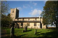
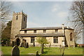
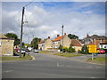
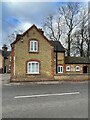
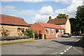
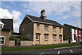
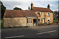
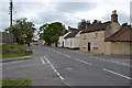
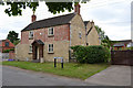
Photos of LN2 3HZ


Area Information
LN2 3HZ is a compact residential postcode in England, covering just 1.8 hectares and home to 1978 residents. With a population density of 200 people per square kilometre, it is a small, tightly knit area where daily life is shaped by its modest scale and local character. The community here is predominantly middle-aged, with a median age of 47 and a strong presence of adults aged 30–64. Most residents own their homes, with 78% of properties in private ownership, and the area is largely composed of houses rather than flats or apartments. This suggests a stable, long-term resident base, with little turnover. Living in LN2 3HZ means proximity to practical amenities like Lincoln Central Railway Station and RAF Scampton, while the area’s low crime risk and minimal environmental constraints make it a quiet, secure place to reside. Its small size means it is ideal for those seeking a close-knit community without the sprawl of larger towns, though its limited footprint also means it is best suited for those prioritising convenience over expansive space.
- Area Type
- Postcode
- Area Size
- 1.8 hectares
- Population
- 1978
- Population Density
- 200 people/km²
The property market in LN2 3HZ is characterised by high home ownership and a predominance of houses. With 78% of properties owned by residents, this is not a rental-heavy area, suggesting a market where long-term investment is prioritised over short-term lettings. The focus on houses rather than flats or apartments indicates a demographic that values private space and traditional housing stock. Given the area’s small size—just 1.8 hectares—there is limited scope for new developments, which could make the market competitive for buyers. The concentration of owner-occupied homes also implies a stable, low-turnover environment, where properties may retain value over time. For prospective buyers, this means a focus on existing homes rather than speculative development, with the potential for strong community ties and established neighbourhood dynamics. However, the limited land area means buyers should consider proximity to nearby towns for additional amenities, as the immediate surroundings may not offer extensive property variety.
House Prices in LN2 3HZ
Showing 30 properties
| Address | Type | Beds | Baths | Last Sale Price | Last Sale Date | |
|---|---|---|---|---|---|---|
| Wella House, 17 Lincoln Road, Welton, Lincoln, LN2 3HZ | house | - | - | £650,000 | Sep 2023 | |
| 15 Lincoln Road, Welton, Lincoln, LN2 3HZ | Semi-detached | - | - | £420,000 | Mar 2020 | |
| Eve House, 19 Lincoln Road, Welton, Lincoln, LN2 3HZ | Detached | 4 | 3 | £450,000 | May 2019 | |
| 23 Lincoln Road, Welton, Lincoln, LN2 3HZ | Detached | 5 | 2 | £400,000 | Dec 2017 | |
| 1B Lincoln Road, Welton, Lincoln, LN2 3HZ | Semi-detached | 3 | 1 | £182,500 | Nov 2017 | |
| 21 Lincoln Road, Welton, Lincoln, LN2 3HZ | house | - | - | £250,000 | Jun 2012 | |
| 5A Lincoln Road, Welton, Lincoln, LN2 3HZ | Flat | 4 | - | - | - | |
| Flat 1, Park House, Lincoln Road, Welton, Lincoln, LN2 3HZ | Flat | 4 | - | - | - | |
| Brook House, 25 Lincoln Road, Welton, Lincoln, LN2 3HZ | Detached | - | - | - | - | |
| Flat 16, Park House, Lincoln Road, Welton, Lincoln, LN2 3HZ | Flat | - | - | - | - |
Energy Efficiency in LN2 3HZ
Living in LN2 3HZ offers access to a range of practical amenities within walking or short driving distance. The area includes five retail outlets, with Lincolnshire Co-operative Co being a notable presence, providing grocery and general shopping options. For travel, Lincoln Central Railway Station offers regional rail connections, while RAF Scampton provides an alternative transport hub, potentially beneficial for those working in or connected to the military. Though the data does not mention parks or leisure facilities, the absence of environmental constraints like protected woodlands or AONB designations suggests the area is free from restrictions on local development or outdoor activities. The compact nature of the postcode means residents can access essential services without lengthy commutes, though the limited land area means the character of the area is defined by its immediate surroundings rather than expansive public spaces. This makes LN2 3HZ ideal for those prioritising convenience and proximity to daily necessities over large-scale recreational facilities.
Amenities
Schools
| Rank | School | Type | Entry gender | Ages |
|---|
Explore more schools in this area
Go to Schools tabDemographics
The demographic profile of LN2 3HZ is defined by its mature population, with a median age of 47 and the majority of residents falling within the 30–64 age range. This suggests a community of established professionals and families, rather than a transient or student population. Home ownership is high, with 78% of residents living in properties they own, indicating a preference for long-term stability. The area is predominantly composed of houses, which aligns with the demographic of older, settled residents. The predominant ethnic group is White, though no specific diversity metrics are provided in the data. The age profile and ownership figures suggest a low dependency ratio, with fewer children or elderly residents relative to the working-age population. This could influence local services and infrastructure needs, with a focus on maintaining existing amenities rather than expanding for growth. The absence of specific deprivation data means the quality of life here is likely aligned with the broader region’s standards, though this remains unquantified.
Household Size
Accommodation Type
Tenure
Ethnic Group
Religion
Household Composition
Age
Household Deprivation
NS-SEC
Explore more demographic insights in this area
Go to Demographics tabPlanning
Planning Constraints
- Flood RiskPremium
- Ramsar Wetland SitesPremium
- Area of Outstanding Natural BeautyPremium
- Protected Nature ReservePremium
- Protected WoodlandPremium