Area Overview for LN2 3FD
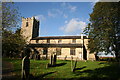
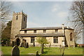
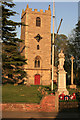
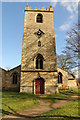
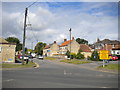
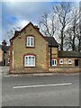
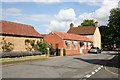
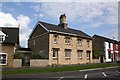
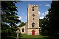
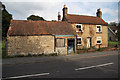
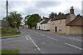
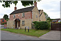
Photos of LN2 3FD
Area Information
Living in LN2 3FD means being part of a tightly knit, compact residential cluster in England. The area spans 7,824 square metres and is home to 2,110 residents, resulting in a remarkably high population density of 269,681 people per square kilometre. This small postcode area is characterised by a mature demographic, with a median age of 47 and a majority of residents aged 30–64. The community is largely composed of homeowners, with 87% of properties occupied by their owners, and the housing stock is predominantly single-family homes. Daily life here is defined by proximity to essential services, including a nearby railway station and a regional airport, while the area’s low crime risk and absence of environmental constraints make it an attractive option for those seeking stability. The compact nature of LN2 3FD means residents are likely to know their neighbours, and the area’s small scale fosters a sense of familiarity. For those prioritising safety, the low flood risk and minimal planning constraints further enhance its appeal.
- Area Type
- Postcode
- Area Size
- 7824 m²
- Population
- 2110
- Population Density
- 3219 people/km²
The property market in LN2 3FD is dominated by owner-occupied homes, with 87% of properties owned by their residents. This high level of home ownership suggests a community focused on long-term investment rather than rental turnover. The accommodation type is primarily houses, which is unusual for areas with high population density but aligns with the area’s small, residential character. Given the compact size of LN2 3FD—just 7,824 square metres—housing stock is limited, and the market is likely to be niche, catering to those prioritising proximity to specific amenities. Buyers should consider that the area’s small scale may restrict property availability, though the dominance of houses could appeal to families seeking space. The lack of flats or apartments may also mean the market is less diverse, potentially limiting options for first-time buyers or those seeking alternative housing types.
House Prices in LN2 3FD
Showing 15 properties
| Address | Type | Beds | Baths | Last Sale Price | Last Sale Date | |
|---|---|---|---|---|---|---|
| 5 The Pastures, Welton, Lincoln, LN2 3FD | Detached | 4 | 2 | £300,000 | Feb 2025 | |
| 10 The Pastures, Welton, Lincoln, LN2 3FD | Detached | 4 | 3 | £374,950 | Nov 2021 | |
| 19 The Pastures, Welton, Lincoln, LN2 3FD | Detached | 4 | - | £350,500 | Dec 2020 | |
| 8 The Pastures, Welton, Lincoln, LN2 3FD | Detached | 4 | 1 | £289,000 | Aug 2018 | |
| 3 The Pastures, Welton, Lincoln, LN2 3FD | house | - | - | £245,000 | Jun 2018 | |
| 11 The Pastures, Welton, Lincoln, LN2 3FD | Detached | 4 | 2 | £285,000 | May 2018 | |
| 1 The Pastures, Welton, Lincoln, LN2 3FD | Detached | 3 | 1 | £240,000 | May 2018 | |
| 6 The Pastures, Welton, Lincoln, LN2 3FD | Detached | 4 | 1 | £270,000 | Apr 2018 | |
| 12 The Pastures, Welton, Lincoln, LN2 3FD | Detached | 4 | - | £210,000 | Aug 2013 | |
| 9 The Pastures, Welton, Lincoln, LN2 3FD | Detached | 4 | 3 | £246,000 | Aug 2007 |
Energy Efficiency in LN2 3FD
Daily life in LN2 3FD is shaped by its proximity to essential amenities. The area includes five retail venues, with Lincolnshire Co-operative Co appearing three times, suggesting a focus on local, community-run shops. While the specific types of retail are not detailed, the repetition of the same name may indicate a limited variety of stores. The presence of Lincoln Central Railway Station and RAF Scampton provides transport options beyond the immediate area, enabling access to broader services. However, the data does not mention parks, leisure facilities, or dining options, meaning the area’s lifestyle offerings are inferred from its transport and retail connectivity. The compact nature of LN2 3FD means residents must travel slightly to access more diverse amenities, but the existing infrastructure supports basic needs and regional mobility.
Amenities
Schools
Residents of LN2 3FD have access to two primary schools: Welton St Mary’s Church of England Primary School and Welton St Mary’s Church of England Primary Academy. Both institutions serve the same age group, ensuring consistent educational provision for young families. The second school holds an Ofsted rating of ‘good’, reflecting its quality of teaching and student outcomes. The presence of two primary schools within the area reduces the need for long commutes to education, which is a significant advantage for parents. However, the absence of secondary schools or specialist provision means families may need to look further afield for higher education. The dual primary options suggest a focus on early years’ education, which aligns with the area’s mature demographic. For those prioritising school quality, the ‘good’ rating at one institution provides a clear benchmark for local standards.
| Rank | School | Type | Entry gender | Ages |
|---|
Explore more schools in this area
Go to Schools tabDemographics
The community in LN2 3FD is predominantly composed of adults aged 30–64, with a median age of 47. This suggests a population that is largely established in careers and family life, contributing to a stable local economy. Home ownership is exceptionally high at 87%, indicating a strong preference for long-term residency over rental properties. The area is primarily occupied by houses rather than flats, reflecting a traditional housing model. The predominant ethnic group is White, which aligns with broader regional demographics but underscores the area’s homogeneity. With such a high proportion of homeowners, the community is likely to have a strong sense of local identity. The age profile suggests a balance between working-age residents and those nearing retirement, which may influence local services and amenities. The absence of specific data on deprivation means this analysis focuses solely on the figures provided, highlighting the area’s demographic consistency and stability.
Household Size
Accommodation Type
Tenure
Ethnic Group
Religion
Household Composition
Age
Household Deprivation
NS-SEC
Explore more demographic insights in this area
Go to Demographics tabPlanning
Planning Constraints
- Flood RiskPremium
- Ramsar Wetland SitesPremium
- Area of Outstanding Natural BeautyPremium
- Protected Nature ReservePremium
- Protected WoodlandPremium