Area Overview for LN2 3BU
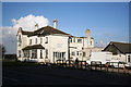
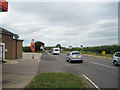
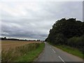
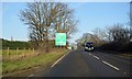
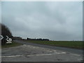
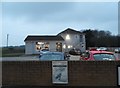
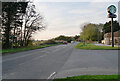
Photos of LN2 3BU


Area Information
Living in LN2 3BU offers a quiet, low-density residential experience in a small cluster of homes. With a population of 1517 spread across 43 people per square kilometre, the area feels unspoiled by urban sprawl. The community is characterised by a mature demographic, with a median age of 47 and most residents aged between 30 and 64. This suggests a stable, established population, likely centred around families or long-term residents. Daily life here is likely unhurried, with local amenities such as Spar and Morrisons within reach. The proximity to RAF Scampton adds a unique backdrop, though the area itself remains focused on residential living. For those seeking a balance between seclusion and practicality, LN2 3BU’s small size and sparse population density make it distinct from larger towns, offering a sense of space without the isolation of rural areas. The lack of major planning constraints, such as protected woodlands or AONB designations, means development is unlikely to disrupt the area’s character.
- Area Type
- Postcode
- Area Size
- Not available
- Population
- 1517
- Population Density
- 43 people/km²
The property market in LN2 3BU is dominated by owner-occupied homes, with 76% of residents living in properties they own. This high rate of home ownership suggests a stable, long-term community with limited rental activity. The accommodation type is primarily houses, which is typical for areas with low population density. This means the housing stock is unlikely to include flats or apartments, making the area more suited to families or individuals seeking space rather than urban convenience. Given the small size of the postcode area, the number of available properties is limited, and buyers should consider the surrounding regions for more options. The focus on houses may also mean higher property values compared to areas with more diverse housing types. For those prioritising a quiet, established environment with minimal development pressure, LN2 3BU’s property market offers a straightforward, if limited, selection of homes.
House Prices in LN2 3BU
No properties found in this postcode.
Energy Efficiency in LN2 3BU
The lifestyle in LN2 3BU is shaped by its small scale and limited amenities. Residents have access to three retail options within practical reach: Spar, Lincolnshire Co-operative Co, and Morrisons Daily Kirton in. These provide basic shopping needs but do not offer the variety of larger towns. The proximity to RAF Scampton adds a unique element, though it is unlikely to influence daily life significantly for non-military residents. The area’s low population density suggests a quieter, more private lifestyle, with fewer crowds and a slower pace. For leisure, the lack of detailed data on parks or recreational facilities means the area’s character is likely defined by its residential tranquillity rather than active amenities. This makes LN2 3BU suitable for those prioritising space and simplicity over a bustling social scene.
Amenities
Schools
The nearest school to LN2 3BU is Ingham Primary School, which holds a ‘good’ Ofsted rating. This indicates a reliable educational foundation for young children, though the absence of secondary schools in the area means families may need to look further afield for secondary education. The presence of a primary school with a positive rating is a key consideration for parents, as it suggests a focus on early education and potentially strong community ties. However, the lack of additional schools in the immediate vicinity may impact convenience for households with older children. The school’s rating and type reflect a focus on primary education, which is critical for young families but does not provide a full spectrum of educational options. Prospective buyers should factor in the need for transport or relocation for secondary schooling.
| Rank | School | Type | Entry gender | Ages |
|---|
Explore more schools in this area
Go to Schools tabDemographics
The community in LN2 3BU is predominantly composed of adults aged 30 to 64, reflecting a mature, settled population. With a median age of 47, the area is less likely to attract young professionals or students, instead catering to families or individuals in later career stages. Home ownership is high at 76%, indicating a strong preference for long-term residency over renting. The accommodation types are primarily houses, which aligns with the low population density and suggests a focus on single-family homes rather than apartments or flats. The predominant ethnic group is White, though no further breakdown of diversity is provided. The relatively low population density of 43 people per square kilometre implies spacious living conditions, which may appeal to those prioritising privacy. However, this also means the area lacks the vibrancy of more densely populated neighbourhoods. The absence of specific deprivation data means the quality of life cannot be assessed in terms of socioeconomic challenges, but the high home ownership and stable age profile suggest a generally secure environment.
Household Size
Accommodation Type
Tenure
Ethnic Group
Religion
Household Composition
Age
Household Deprivation
NS-SEC
Explore more demographic insights in this area
Go to Demographics tabPlanning
Planning Constraints
- Flood RiskPremium
- Ramsar Wetland SitesPremium
- Area of Outstanding Natural BeautyPremium
- Protected Nature ReservePremium
- Protected WoodlandPremium