Area Overview for LN2 2UR
Photos of LN2 2UR


Area Information
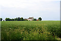
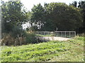
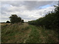
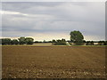
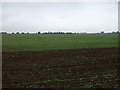
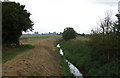
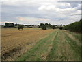
Living in LN2 2UR means inhabiting a small, tightly knit residential cluster in England, covering just 1.8 km² with a population of 1,523. This area is characterised by its compact size and low population density of 129 people per square kilometre, suggesting a quiet, perhaps semi-rural or suburban setting. The community here skews older, with a median age of 47 and most residents falling within the 30–64 age range. Home ownership is high at 84%, with houses predominating over flats or other property types. The area lacks major urban amenities but offers a sense of seclusion, though its small size means proximity to nearby towns or cities is likely. Daily life here would revolve around local retail options and essential services, with the nearest airport at RAF Scampton. While the area’s size limits extensive infrastructure, its low crime risk and manageable population density suggest a peaceful environment for those prioritising tranquillity over urban convenience.
- Area Type
- Postcode
- Area Size
- 1.8 km²
- Population
- 1523
- Population Density
- 129 people/km²
The property market in LN2 2UR is dominated by owner-occupied homes, with 84% of properties owned outright. This high rate of home ownership suggests a community of long-term residents rather than a transient rental market. The accommodation type is predominantly houses, which is unusual for areas with higher population densities but aligns with the low density of 129 people per square kilometre. This indicates a focus on single-family homes, likely appealing to families or individuals seeking space. Given the area’s small size, the housing stock is likely limited, which could make it a competitive market for buyers. Prospective buyers should consider the scarcity of properties and the potential for limited development opportunities. The predominance of houses also suggests that the area may not cater to younger professionals or those requiring smaller, more flexible living spaces.
House Prices in LN2 2UR
No properties found in this postcode.
Energy Efficiency in LN2 2UR
The lifestyle in LN2 2UR is shaped by its proximity to a handful of retail outlets, including three instances of Lincolnshire Co-operative Co, which may indicate a focus on local shopping and community services. The nearest airport, RAF Scampton, is within reach, potentially offering travel convenience for residents. However, the area lacks parks, leisure facilities, or dining options explicitly listed in the data, suggesting a minimalistic approach to amenities. The small number of retail venues implies a limited selection for shopping, though the presence of a co-operative store could provide essential goods. Overall, the area’s lifestyle appears to prioritise practicality over extensive leisure options, with residents likely relying on nearby towns for more comprehensive facilities.
Amenities
Schools
The nearest school to LN2 2UR is Ellison Boulters Church of England Primary School, which serves the local community. This is the only school listed in the data, and it is a primary school with a good Ofsted rating. The absence of secondary schools in the immediate vicinity means families may need to look beyond the area for secondary education options. The presence of a single primary school suggests that the local education infrastructure is limited, which could be a consideration for parents planning for their children’s long-term schooling. The good Ofsted rating indicates a reliable standard of education, but the lack of diversity in school types—no secondary or specialist institutions—may require additional commuting for older students.
| Rank | School | Type | Entry gender | Ages |
|---|---|---|---|---|
| 1 | Ellison Boulters Church of England Primary School | primary | N/A | N/A |
| 2 | Ellison Boulters Church of England Primary School | primary | N/A | N/A |
Explore more schools in this area
Go to Schools tabDemographics
The community in LN2 2UR is predominantly composed of adults aged 30–64, with a median age of 47. This suggests a mature population, likely with established careers and families. Home ownership is exceptionally high at 84%, indicating a stable, long-term resident base rather than a transient rental market. The accommodation type is largely houses, which aligns with the area’s low population density and suggests a focus on family homes. The predominant ethnic group is White, reflecting a homogenous demographic profile. While no specific deprivation data is provided, the high home ownership and age distribution imply a relatively stable economic environment. However, the lack of diversity in ethnic composition may limit cultural vibrancy. The area’s small size and older demographic could influence local services and amenities, potentially shaping a community with strong intergenerational ties but limited youthful energy.
Household Size
Accommodation Type
Tenure
Ethnic Group
Religion
Household Composition
Age
Household Deprivation
NS-SEC
Explore more demographic insights in this area
Go to Demographics tabPlanning
Planning Constraints
- Flood RiskPremium
- Ramsar Wetland SitesPremium
- Area of Outstanding Natural BeautyPremium
- Protected Nature ReservePremium
- Protected WoodlandPremium
- Crime RiskPremium