Area Overview for LN2 2TQ
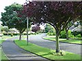
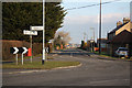
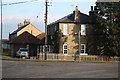
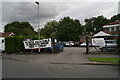
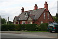
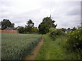
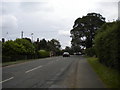
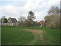
Photos of LN2 2TQ
Area Information
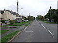
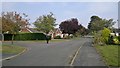
Living in LN2 2TQ means being part of a tightly knit residential cluster in England, where 1,510 people reside across just 1.5 hectares. This small area is characterised by its compact size and high population density of 1,439 people per square kilometre, creating a closely connected community. Daily life here is shaped by proximity to essential services, with homes predominantly occupied by owners and a focus on family living. The area’s proximity to Lincoln Central Railway Station and nearby retail hubs like Asda Lincoln and Iceland Nettleham ensures practicality for residents. While the population skews older, with the majority aged 65+, the presence of multiple primary schools suggests a family-oriented environment. LN2 2TQ is not a sprawling suburb but a defined postcode cluster where community ties are likely strong, and local amenities are within walking distance. For buyers seeking a compact, well-served area with a mix of residential and retail access, this postcode offers a straightforward, no-frills living experience.
- Area Type
- Postcode
- Area Size
- 1.5 hectares
- Population
- 1510
- Population Density
- 1439 people/km²
The property market in LN2 2TQ is dominated by owner-occupied homes, with 80% of properties in private hands. This contrasts with areas where rental demand drives the market, suggesting a community of long-term residents rather than short-term tenants. The accommodation type is exclusively houses, which is unusual for a small postcode area but may reflect the compact, residential nature of the cluster. With only 1.5 hectares of space and 1,510 residents, the housing stock is likely limited in number but possibly larger in size. Buyers should consider that this is not a high-density urban area but a small, tightly packed cluster where property availability may be constrained. The high home ownership rate indicates a stable market, though the limited size of the area means competition for properties could be fierce. Those seeking a family home with a focus on security and established community ties may find LN2 2TQ appealing.
House Prices in LN2 2TQ
Showing 30 properties
| Address | Type | Beds | Baths | Last Sale Price | Last Sale Date | |
|---|---|---|---|---|---|---|
| 28 Ashtree Avenue, Nettleham, Lincoln, LN2 2TQ | Detached | 4 | 2 | £382,000 | May 2025 | |
| 6 Ashtree Avenue, Nettleham, Lincoln, LN2 2TQ | Retail | 3 | 1 | £280,000 | Jun 2022 | |
| 34 Ashtree Avenue, Nettleham, Lincoln, LN2 2TQ | Detached | 3 | 1 | £190,000 | Dec 2019 | |
| 38 Ashtree Avenue, Nettleham, Lincoln, LN2 2TQ | house | - | - | £201,000 | Apr 2019 | |
| 12 Ashtree Avenue, Nettleham, Lincoln, LN2 2TQ | Detached | 4 | 1 | £250,000 | May 2017 | |
| 13 Ashtree Avenue, Nettleham, Lincoln, LN2 2TQ | Bungalow | - | - | £125,000 | Feb 2017 | |
| 4 Ashtree Avenue, Nettleham, Lincoln, LN2 2TQ | Bungalow | 3 | 1 | £172,000 | Jan 2015 | |
| 2 Ashtree Avenue, Nettleham, Lincoln, LN2 2TQ | Detached | - | - | £185,000 | Dec 2014 | |
| 17 Ashtree Avenue, Nettleham, Lincoln, LN2 2TQ | Detached | 3 | 1 | £184,950 | Sep 2014 | |
| 5 Ashtree Avenue, Nettleham, Lincoln, LN2 2TQ | Detached | 3 | 2 | £170,000 | Mar 2014 |
Energy Efficiency in LN2 2TQ
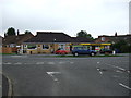
The lifestyle in LN2 2TQ is shaped by its proximity to retail, transport, and local services. Within practical reach are five retail outlets, including the Lincolnshire Co-operative Co, Asda Lincoln, and Iceland Nettleham, offering everyday shopping needs. The Lincoln Central Railway Station provides access to regional travel, while RAF Scampton, though a military base, may influence the local character. The area lacks detailed data on parks or leisure facilities, but the presence of multiple schools and retail hubs suggests a focus on practicality over recreation. For residents, daily life revolves around nearby shops, schools, and the railway. The compact nature of the area means amenities are close, though the absence of detailed leisure options may require trips to larger towns. This postcode is ideal for those prioritising convenience over expansive recreational spaces.
Amenities
Schools
Residents of LN2 2TQ have access to three primary schools within practical reach. The Nettleham Church of England Voluntary Aided Junior School and The Nettleham Infant School both offer primary education, while The Nettleham Infant and Nursery School is an academy with a good Ofsted rating. This mix of school types provides options for parents, including a state-funded school with a religious affiliation and a standalone academy. The presence of three primary schools in close proximity suggests a strong focus on education in the area, catering to younger families. However, no secondary schools are listed, so parents may need to consider commuting for older children. The good Ofsted rating at one school indicates at least one institution meeting high standards, though the overall quality of education would depend on individual school performance.
| Rank | School | Type | Entry gender | Ages |
|---|
Explore more schools in this area
Go to Schools tabDemographics
The demographic profile of LN2 2TQ is defined by its elderly population, with 65+ year-olds making up the largest age group. The median age of 47 suggests a community where older residents are well-represented, though younger families are also present, evidenced by the three primary schools nearby. Home ownership is high at 80%, indicating a stable, long-term resident base rather than a transient rental market. The predominant accommodation type is houses, which aligns with the area’s small size and density. Ethnically, the population is largely White, with no data provided on other groups. The high home ownership rate and presence of family-focused schools suggest a community prioritising stability and education. However, the lack of diversity data means the full picture of social composition remains incomplete. For those considering LN2 2TQ, the demographic profile reflects a mature, family-oriented area with established residential patterns.
Household Size
Accommodation Type
Tenure
Ethnic Group
Religion
Household Composition
Age
Household Deprivation
NS-SEC
Explore more demographic insights in this area
Go to Demographics tabPlanning
Planning Constraints
- Flood RiskPremium
- Ramsar Wetland SitesPremium
- Area of Outstanding Natural BeautyPremium
- Protected Nature ReservePremium
- Protected WoodlandPremium