Area Overview for LN2 2RB
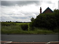
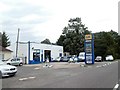
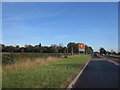
Photos of LN2 2RB


Area Information
Living in LN2 2RB means inhabiting a compact, residential postcode area in England, covering 2,956 square metres and home to 1,189 people. With a population density of 697 people per square kilometre, this small cluster of homes fosters a tight-knit community. The area is characterised by its predominantly owner-occupied housing stock, with 93% of residents living in their own homes. This suggests a stable, long-term population, likely centred around middle-aged adults aged 30–64, who make up the majority of the demographic. Daily life here is shaped by proximity to Lincoln Central Railway Station, offering connections to the city, and RAF Scampton, which may provide employment or recreational opportunities. The area’s low flood risk and minimal environmental constraints make it a practical choice for those prioritising safety and planning certainty. While the retail options are limited to a few shops, including multiple branches of Lincolnshire Co-operative Co, the area’s small size means residents are close to essential services. For buyers, LN2 2RB offers a quiet, established environment with a clear focus on homeownership and community stability.
- Area Type
- Postcode
- Area Size
- 2956 m²
- Population
- 1189
- Population Density
- 697 people/km²
The property market in LN2 2RB is dominated by owner-occupied homes, with 93% of residents living in their own properties. This high level of home ownership suggests a mature market with limited turnover, where properties are likely to be held for extended periods. The accommodation type is exclusively houses, which is unusual for a small postcode area but may indicate a focus on family homes or larger properties. Given the compact size of the area—just 2,956 square metres—there is little scope for new development, making the existing housing stock highly valuable. Buyers should expect a competitive market, with properties in demand due to their rarity and the area’s low crime risk. The absence of rental properties also means that those seeking to buy may find limited options for investment or rental income. For those considering LN2 2RB, the emphasis on homeownership and the presence of houses rather than flats or apartments may appeal to buyers prioritising space and long-term stability.
House Prices in LN2 2RB
Showing 4 properties
| Address | Type | Beds | Baths | Last Sale Price | Last Sale Date | |
|---|---|---|---|---|---|---|
| 1 Chestnut Drive, Sudbrooke, Lincoln, LN2 2RB | Bungalow | 4 | 2 | £190,000 | Mar 2003 | |
| 2 Chestnut Drive, Sudbrooke, Lincoln, LN2 2RB | Detached | 4 | 1 | £76,000 | Jan 1996 | |
| Topaz, 4 Chestnut Drive, Sudbrooke, Lincoln, LN2 2RB | Detached | - | - | - | - | |
| 6 Chestnut Drive, Sudbrooke, Lincoln, LN2 2RB | Detached | - | - | - | - |
Energy Efficiency in LN2 2RB
Daily life in LN2 2RB is shaped by its proximity to a small selection of retail outlets, including three branches of Lincolnshire Co-operative Co, which provide essential shopping and services. The area’s limited size means these shops are within practical walking or driving distance for most residents. The Lincoln Central Railway Station offers a gateway to broader travel options, whether for commuting to Lincoln or exploring further afield. However, the absence of dedicated leisure facilities, parks, or dining venues outside the retail options suggests a lifestyle focused on practicality rather than recreation. The nearby RAF Scampton may offer unique opportunities for those with specific interests, but it is not a civilian hub. For residents, the area’s charm lies in its simplicity: a quiet, established community with minimal amenities, ideal for those who prioritise convenience and a low-maintenance lifestyle.
Amenities
Schools
| Rank | School | Type | Entry gender | Ages |
|---|
Explore more schools in this area
Go to Schools tabDemographics
The community in LN2 2RB is predominantly middle-aged, with a median age of 47 and 30–64-year-olds forming the largest age group. This suggests a population skewed towards families or individuals in their prime working years. Home ownership is exceptionally high at 93%, indicating a strong preference for long-term residency over rental living. The accommodation type is exclusively houses, which aligns with the area’s low population density and compact size. The predominant ethnic group is White, reflecting a homogenous demographic profile. With 1,189 residents spread across 2,956 square metres, the area is densely populated relative to its size, which may influence the availability of private outdoor space. The absence of specific data on deprivation or diversity metrics means the quality of life is inferred from the high home ownership rate and low crime risk. This profile suggests a community that values stability, with residents likely prioritising family-oriented living and long-term investment in property.
Household Size
Accommodation Type
Tenure
Ethnic Group
Religion
Household Composition
Age
Household Deprivation
NS-SEC
Explore more demographic insights in this area
Go to Demographics tabPlanning
Planning Constraints
- Flood RiskPremium
- Ramsar Wetland SitesPremium
- Area of Outstanding Natural BeautyPremium
- Protected Nature ReservePremium
- Protected WoodlandPremium