Area Overview for LN2 2GG
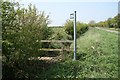
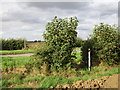
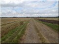
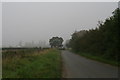
Photos of LN2 2GG


Area Information
LN2 2GG is a small, compact residential area in England, covering 5.7 hectares and home to 1523 residents. Its low population density of 129 people per square kilometre suggests a quiet, spacious living environment. The area is characterised by a mix of houses, with 84% of residents owning their homes. This makes it a stable, family-oriented neighbourhood where most properties are occupied by long-term residents. Proximity to Lincoln Central Railway Station and RAF Scampton offers practical transport links, while nearby retail options, including multiple Lincolnshire Co-operative Co outlets, provide convenience. The area’s modest size means it is likely to feel close-knit, with a focus on local amenities rather than sprawling urban sprawl. For those seeking a low-key, community-focused lifestyle with access to essential services, LN2 2GG offers a straightforward, uncluttered living experience.
- Area Type
- Postcode
- Area Size
- 5.7 hectares
- Population
- 1523
- Population Density
- 129 people/km²
LN2 2GG is primarily an owner-occupied area, with 84% of residents living in homes they own. The accommodation types here are predominantly houses, which is typical of smaller, residential clusters where family homes dominate. This suggests a market that caters to buyers seeking long-term investment rather than short-term rental opportunities. The small area size means the housing stock is limited, but the high home ownership rate indicates strong local demand. For buyers, this could mean a competitive market with fewer properties available, though the focus on owner-occupation may reduce pressure from speculative investment. The presence of nearby amenities, such as Lincoln Central Station, adds to the area’s appeal for those prioritising convenience over larger property selections.
House Prices in LN2 2GG
Showing 27 properties
| Address | Type | Beds | Baths | Last Sale Price | Last Sale Date | |
|---|---|---|---|---|---|---|
| 16 Saint Germains Way, Scothern, Lincoln, LN2 2GG | Detached | 3 | 3 | £435,000 | Jul 2025 | |
| 28 Saint Germains Way, Scothern, Lincoln, LN2 2GG | Detached | 4 | 3 | £559,200 | Jan 2025 | |
| 2 Saint Germains Way, Scothern, Lincoln, LN2 2GG | Detached | 4 | 3 | £380,000 | May 2023 | |
| Bluebells, 6A Saint Germains Way, Scothern, Lincoln, LN2 2GG | house | - | - | £325,000 | Feb 2022 | |
| 9 Saint Germains Way, Scothern, Lincoln, LN2 2GG | house | - | - | £625,000 | Jan 2022 | |
| 12 Saint Germains Way, Scothern, Lincoln, LN2 2GG | house | - | - | £410,000 | Jun 2021 | |
| 10 Saint Germains Way, Scothern, Lincoln, LN2 2GG | house | - | - | £452,500 | Jun 2021 | |
| 5 Saint Germains Way, Scothern, Lincoln, LN2 2GG | house | - | - | £510,000 | May 2021 | |
| 8 Saint Germains Way, Scothern, Lincoln, LN2 2GG | Detached | 3 | 2 | £345,000 | Mar 2021 | |
| 15 Saint Germains Way, Scothern, Lincoln, LN2 2GG | Detached | 5 | 3 | £575,000 | Mar 2021 |
Energy Efficiency in LN2 2GG
The lifestyle in LN2 2GG is shaped by its proximity to practical amenities. The area includes five retail outlets, predominantly Lincolnshire Co-operative Co stores, which provide essential shopping options. Nearby, Lincoln Central Railway Station offers easy access to regional travel, while RAF Scampton serves as a notable landmark. Though the area lacks large-scale leisure facilities, the presence of multiple retail points and transport links ensures daily conveniences are within reach. The low population density and focus on houses suggest a lifestyle prioritising space and quiet over urban vibrancy. Residents can expect a straightforward, no-frills approach to living, with amenities tailored to basic needs rather than luxury or extensive recreational options.
Amenities
Schools
The nearest school to LN2 2GG is Ellison Boulters Church of England Primary School, which serves the local community with a primary education offering. The school has an Ofsted rating of ‘good’, reflecting its ability to meet educational standards effectively. As the sole listed school in the area, it is the primary option for families with young children. The absence of secondary schools or other educational institutions nearby means parents may need to consider commuting for secondary education. However, the ‘good’ rating suggests a reliable, well-regulated learning environment for primary-age students, which is a key factor for families prioritising school quality in their housing decisions.
| Rank | School | Type | Entry gender | Ages |
|---|
Explore more schools in this area
Go to Schools tabDemographics
The population of LN2 2GG skews towards adults aged 30–64, with a median age of 47. This suggests a mature, established community with a strong presence of families and professionals in their prime earning years. Home ownership is high at 84%, indicating a preference for long-term residency over rental properties. The area is predominantly White, with no specific data on other ethnic groups provided. The low population density of 129 people per square kilometre implies a less congested environment, which may contribute to a relaxed pace of life. While no explicit data on deprivation is available, the high home ownership rate and stable demographics suggest a relatively secure economic profile. This aligns with the area’s safety scores and the absence of environmental constraints, which together support a quality of life focused on stability and low risk.
Household Size
Accommodation Type
Tenure
Ethnic Group
Religion
Household Composition
Age
Household Deprivation
NS-SEC
Explore more demographic insights in this area
Go to Demographics tabPlanning
Planning Constraints
- Flood RiskPremium
- Ramsar Wetland SitesPremium
- Area of Outstanding Natural BeautyPremium
- Protected Nature ReservePremium
- Protected WoodlandPremium