Area Overview for LN2 2GB
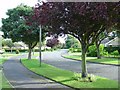
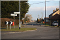
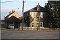
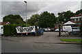
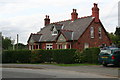
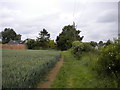
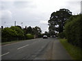
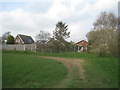
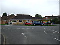
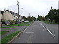
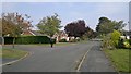
Photos of LN2 2GB
Area Information
Living in LN2 2GB offers a compact, residential experience shaped by its small footprint of 11.7 hectares and a population of 2,353. This postcode area, located in England, is a tight-knit cluster where the average household owns their home, reflecting a community rooted in stability. With a median age of 47 and a majority of residents aged 30–64, the area caters to families and professionals seeking a quieter, established environment. Daily life here is defined by proximity to essential services, including retail outlets and transport links. The low population density of 133 people per square kilometre ensures a sense of space, though the area’s size means it is best suited for those prioritising convenience over expansive surroundings. LN2 2GB’s character is built on its practicality: homes are predominantly owner-occupied, and the community is largely homogenous, with White residents forming the majority. For buyers, this area represents a blend of simplicity and accessibility, with a focus on functional living over urban amenities.
- Area Type
- Postcode
- Area Size
- 11.7 hectares
- Population
- 2353
- Population Density
- 133 people/km²
The property market in LN2 2GB is characterised by a high rate of home ownership (74%), with houses forming the primary accommodation type. This suggests a market skewed towards owner-occupation rather than rental, likely attracting buyers seeking long-term stability. The small area size of 11.7 hectares means the housing stock is limited, which could influence property values and availability. For buyers, this presents a challenge: the immediate surroundings may offer few alternatives, requiring consideration of nearby areas for expansion. The predominance of houses implies a focus on family homes, with less emphasis on apartments or flats. This aligns with the area’s demographic profile of older, established residents. However, the limited scale of the area means that property searches here must be approached with precision, as the options are confined to a specific postcode cluster.
House Prices in LN2 2GB
Showing 34 properties
| Address | Type | Beds | Baths | Last Sale Price | Last Sale Date | |
|---|---|---|---|---|---|---|
| 27 Larch Avenue, Nettleham, Lincoln, LN2 2GB | Detached | 4 | 2 | £390,000 | Aug 2025 | |
| 6 Larch Avenue, Nettleham, Lincoln, LN2 2GB | house | 5 | 3 | £457,500 | Jul 2025 | |
| 15 Larch Avenue, Nettleham, Lincoln, LN2 2GB | house | - | - | £101,000 | Nov 2021 | |
| 12 Larch Avenue, Nettleham, Lincoln, LN2 2GB | house | 4 | 2 | £380,000 | Sep 2020 | |
| 8 Larch Avenue, Nettleham, Lincoln, LN2 2GB | Detached | 3 | 1 | £265,000 | Sep 2020 | |
| 18 Larch Avenue, Nettleham, Lincoln, LN2 2GB | house | - | - | £237,500 | May 2020 | |
| 16 Larch Avenue, Nettleham, Lincoln, LN2 2GB | Detached | 4 | 2 | £300,000 | May 2019 | |
| 22 Larch Avenue, Nettleham, Lincoln, LN2 2GB | Detached | 4 | 2 | £270,000 | Jul 2017 | |
| 23 Larch Avenue, Nettleham, Lincoln, LN2 2GB | Detached | 3 | 2 | £225,000 | Jul 2017 | |
| Parkgate, 10 Larch Avenue, Nettleham, Lincoln, LN2 2GB | Detached | 3 | - | £245,000 | Jul 2016 |
Energy Efficiency in LN2 2GB
Residents of LN2 2GB have access to a modest but functional range of amenities. Five retail outlets, including Asda Lincoln and Lincolnshire Co-operative Co, provide everyday shopping options, while Lincoln Central Railway Station ensures connectivity to nearby towns and cities. The proximity to RAF Scampton adds a unique element, though it is primarily a transport hub rather than a leisure destination. For leisure, the area’s small size means that parks or recreational spaces are not explicitly listed in the data, suggesting that residents may need to venture beyond the postcode for outdoor activities. The character of daily life here is defined by convenience: essential services are within reach, but the area’s compact nature means it is best suited for those who prioritise proximity to key facilities over expansive recreational options.
Amenities
Schools
The schools near LN2 2GB include High Leas Education Centre and Northmoor Primary School – Lincoln Campus, both of which are independent institutions. These schools cater to different educational needs, offering private alternatives to state-run options. The presence of two independent schools suggests a community where families may prioritise fee-paying education, though the data does not specify Ofsted ratings or academic performance. For parents, this mix provides flexibility, though the lack of state schools could be a consideration for those seeking public education. The absence of additional schools in the data means the area’s educational offerings are limited to these two institutions, requiring families to assess whether they meet their child’s requirements.
| Rank | School | Type | Entry gender | Ages |
|---|
Explore more schools in this area
Go to Schools tabDemographics
The demographic profile of LN2 2GB is defined by its median age of 47, with the largest age group spanning 30–64 years. This suggests a mature, settled population, likely comprising professionals and families. Home ownership is high, at 74%, indicating a community where property is primarily a long-term investment. The accommodation type is predominantly houses, aligning with the area’s residential character. The predominant ethnic group is White, reflecting a homogenous demographic. With a population density of 133 people per square kilometre, the area avoids overcrowding, offering a balance between community interaction and personal space. The absence of specific deprivation data means the quality of life here is inferred from the stability of ownership and the age profile, which suggests a low turnover of residents. This demographic structure supports a consistent local economy and social fabric, with fewer transient populations compared to larger urban centres.
Household Size
Accommodation Type
Tenure
Ethnic Group
Religion
Household Composition
Age
Household Deprivation
NS-SEC
Explore more demographic insights in this area
Go to Demographics tabPlanning
Planning Constraints
- Flood RiskPremium
- Ramsar Wetland SitesPremium
- Area of Outstanding Natural BeautyPremium
- Protected Nature ReservePremium
- Protected WoodlandPremium