Area Overview for LN2 2BW
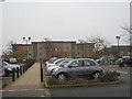
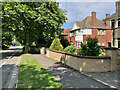
Photos of LN2 2BW


Area Information
LN2 2BW is a small residential postcode area in England, home to 1,567 people. It is a compact cluster of homes, predominantly occupied by adults aged 30–64, with a median age of 47. The area’s modest size means it is likely to have a close-knit character, with residents familiar with their immediate surroundings. Daily life here is shaped by its proximity to Lincoln, a city with cultural and economic significance. The area benefits from good transport links, with three railway stations within reach, and is near two RAF bases, offering potential employment opportunities. While it is not a densely populated region, its small scale means community interactions are likely to be frequent. The area’s low crime risk and absence of environmental constraints make it an appealing option for those seeking a stable, low-maintenance lifestyle. For buyers, the mix of owner-occupied homes and limited rental stock suggests a focus on long-term residency rather than transient populations.
- Area Type
- Postcode
- Area Size
- Not available
- Population
- 1567
- Population Density
- 3114 people/km²
The property market in LN2 2BW is characterised by high home ownership (80%) and a focus on houses rather than flats or apartments. This suggests a market dominated by owner-occupied properties, with limited rental availability. The area’s small size means housing stock is likely to be limited, but the prevalence of houses indicates a preference for larger, more traditional homes. For buyers, this implies a market where properties are held long-term, reducing competition from short-term renters. The lack of flats or shared ownership schemes may appeal to those seeking private, spacious living. However, the small scale of the area means buyers should consider proximity to nearby towns for broader housing options. The stability of the market, combined with low crime risk, makes it an attractive prospect for those prioritising security and permanence.
House Prices in LN2 2BW
No properties found in this postcode.
Energy Efficiency in LN2 2BW
Residents of LN2 2BW have access to a range of amenities within practical reach. The area includes five retail outlets, such as Lincolnshire Co-operative Co and Waitrose Lincoln, providing shopping and grocery options. Three railway stations offer easy access to nearby towns and cities, enhancing connectivity for leisure and commuting. Two RAF bases nearby may influence the local economy, though their impact on civilian amenities is not detailed. The absence of parks or leisure facilities in the data means that residents may need to travel to nearby areas for outdoor activities. Nonetheless, the proximity to retail and transport hubs supports a convenient lifestyle, particularly for those prioritising accessibility over local recreational spaces.
Amenities
Schools
There are no schools explicitly listed in the data for LN2 2BW. The nearest notable educational institution is Bishop Grosseteste University, categorised as an 'other' type, which is a higher education establishment rather than a primary or secondary school. Families requiring schools for children would need to look beyond the immediate area, potentially commuting to nearby towns or cities. The absence of local schools suggests that the area may cater more to older residents or those with access to alternative educational provisions. For prospective buyers with school-aged children, it is essential to research nearby towns for comprehensive educational facilities.
| Rank | School | Type | Entry gender | Ages |
|---|
Explore more schools in this area
Go to Schools tabDemographics
The population of LN2 2BW is predominantly adults aged 30–64, with a median age of 47. This indicates a mature community, likely with established careers and families. Home ownership is high, with 80% of residents living in their own homes, compared to the national average. The accommodation type is primarily houses, suggesting a more traditional housing stock with larger properties. The predominant ethnic group is White, though no further breakdown of diversity is provided. The age profile and home ownership rate imply a relatively stable population with low turnover. The absence of specific data on deprivation means it is unclear whether the area faces socioeconomic challenges, but the low crime risk and lack of environmental constraints suggest a generally secure environment. This demographic profile aligns with a community prioritising stability and long-term residency.
Household Size
Accommodation Type
Tenure
Ethnic Group
Religion
Household Composition
Age
Household Deprivation
NS-SEC
Explore more demographic insights in this area
Go to Demographics tabPlanning
Planning Constraints
- Flood RiskPremium
- Ramsar Wetland SitesPremium
- Area of Outstanding Natural BeautyPremium
- Protected Nature ReservePremium
- Protected WoodlandPremium