Area Overview for LN2 1SP
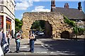
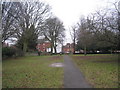
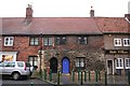
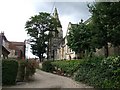
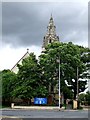
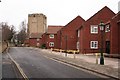
Photos of LN2 1SP

Area Information
Living in LN2 1SP means inhabiting a compact, residential postcode area in England, covering just 1.7 hectares. With a population of 1,567 people, it is densely populated at 91,051 people per square kilometre, reflecting a tight-knit community. The area’s small size and high density suggest a focus on close-knit living, though its proximity to transport links and amenities may offer convenience. Residents here are predominantly adults aged 30–64, with a median age of 47, indicating a mature population. The area’s housing stock is largely owner-occupied, with 80% of homes owned by residents, and most properties are houses rather than flats. This suggests a stable, settled community. The absence of environmental constraints like protected woodlands or wetlands means development is unlikely to be restricted, though the area’s safety profile is strong, with low crime risk and no flood risk. Daily life in LN2 1SP is shaped by its proximity to rail stations and airports, offering connectivity to nearby cities and towns, while the compact size ensures a sense of familiarity among neighbours.
- Area Type
- Postcode
- Area Size
- 1.7 hectares
- Population
- 1567
- Population Density
- 3114 people/km²
The property market in LN2 1SP is dominated by owner-occupied homes, with 80% of residences owned by residents rather than rented. This high home ownership rate indicates a stable, long-term community with limited rental activity, which may affect the availability of short-term lets or investment opportunities. The area’s housing stock is primarily composed of houses, rather than flats or apartments, suggesting a focus on family-oriented or semi-detached living. Given the postcode’s small size—just 1.7 hectares—the housing supply is limited, which may drive competition among buyers. The compact nature of the area also means that properties are likely to be in close proximity to one another, potentially limiting privacy or space. For buyers, this suggests a market where properties are likely to be in demand, particularly among those seeking a settled, low-crime environment. However, the absence of nearby schools or amenities beyond retail and transport links may be a consideration for families or those prioritising convenience.
House Prices in LN2 1SP
Showing 12 properties
| Address | Type | Beds | Baths | Last Sale Price | Last Sale Date | |
|---|---|---|---|---|---|---|
| 11 Elvin Close, Lincoln, LN2 1SP | house | - | - | £276,000 | Jul 2021 | |
| 7 Elvin Close, Lincoln, LN2 1SP | Detached | 3 | 1 | £280,000 | Mar 2021 | |
| 1 Elvin Close, Lincoln, LN2 1SP | Semi-detached | 3 | - | £276,500 | Sep 2020 | |
| 2 Elvin Close, Lincoln, LN2 1SP | house | - | - | £184,000 | Aug 2009 | |
| 8 Elvin Close, Lincoln, LN2 1SP | house | - | - | £225,000 | Nov 2008 | |
| 3 Elvin Close, Lincoln, LN2 1SP | Semi-detached | - | - | £192,500 | Nov 2006 | |
| 12 Elvin Close, Lincoln, LN2 1SP | Semi-detached | - | - | £181,500 | Oct 2006 | |
| 9 Elvin Close, Lincoln, LN2 1SP | Detached | - | - | £220,000 | Jun 2005 | |
| 6 Elvin Close, Lincoln, LN2 1SP | Detached | - | - | £99,950 | Jun 2001 | |
| 10 Elvin Close, Lincoln, LN2 1SP | Semi-detached | - | - | - | - |
Energy Efficiency in LN2 1SP
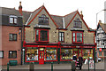
The lifestyle in LN2 1SP is shaped by its proximity to retail, rail, and air transport. The area has five retail outlets, including three branches of Lincolnshire Co-operative Co, offering local shopping options. While the selection is limited, these stores may provide convenience for everyday purchases. The three nearby rail stations—Lincoln Central, Hykeham, and Saxilby—offer access to regional services, while RAF Scampton and RAF Waddington provide opportunities for travel or commuting. However, the absence of parks, leisure facilities, or dining venues in the data means the area’s recreational options are not detailed. The compact nature of LN2 1SP suggests a focus on functional living, with transport and retail serving as the primary amenities. For residents prioritising convenience over leisure, the area’s connectivity and proximity to services may be its strongest assets.
Amenities
Schools
The nearest school to LN2 1SP is Bishop Grosseteste University, categorised as an "other" institution. This suggests it is not a primary or secondary school but likely a higher education or vocational training provider. The absence of listed primary or secondary schools in the data means families seeking schools for younger children may need to look beyond the immediate area. This could be a limitation for buyers prioritising proximity to schools, though the nearby rail network may provide access to educational institutions in larger towns. The lack of specific Ofsted ratings or school types in the data means further research would be required to assess the quality of local education. For now, the area’s educational offerings are limited to higher-level institutions, which may not meet the needs of all residents.
| Rank | School | Type | Entry gender | Ages |
|---|
Explore more schools in this area
Go to Schools tabDemographics
The community in LN2 1SP is predominantly composed of adults aged 30–64, making up the most common age range, with a median age of 47. This suggests a mature, established population, likely with long-term ties to the area. Home ownership is high, with 80% of residents owning their homes, indicating a stable housing market and a preference for long-term residency. The area is characterised by houses rather than flats, reflecting a suburban or semi-rural living pattern. The predominant ethnic group is White, though specific data on diversity or minority representation is not provided. The population density of 91,051 people per square kilometre highlights a tightly packed residential cluster, which may influence the pace of life and availability of shared spaces. While no deprivation data is included, the high home ownership rate and low crime risk suggest a relatively affluent or secure environment. However, the absence of specific data on income levels or socioeconomic diversity means these factors remain unexplored.
Household Size
Accommodation Type
Tenure
Ethnic Group
Religion
Household Composition
Age
Household Deprivation
NS-SEC
Explore more demographic insights in this area
Go to Demographics tabPlanning
Planning Constraints
- Flood RiskPremium
- Ramsar Wetland SitesPremium
- Area of Outstanding Natural BeautyPremium
- Protected Nature ReservePremium
- Protected WoodlandPremium