Area Overview for LN2 1PS
Photos of LN2 1PS
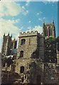


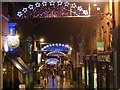
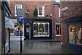
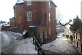
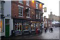


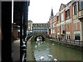
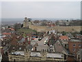
100 photos from this area
Area Information
Key information about the LN2 1PS including its size, population, and administrative classification.
- Area Type
- Postcode
- Area Size
- 2628 m²
- Population
- 1827
- Population Density
- 2768 people/km²
House Prices in LN2 1PS
20
Properties
£187,562
Average Sold Price
£134,737
Lowest Price
£245,000
Highest Price
Showing 20 properties
| Address | Type | Beds | Baths | Last Sale Price | Last Sale Date | |
|---|---|---|---|---|---|---|
| 5 Greestone Mount, Lincoln, LN2 1PS | Flat | - | - | £245,000 | Mar 2024 | |
| 3 Greestone Mount, Lincoln, LN2 1PS | Flat | 2 | 1 | £230,000 | Feb 2023 | |
| 16 Greestone Mount, Lincoln, LN2 1PS | Flat | 2 | 2 | £210,000 | Dec 2022 | |
| 15 Greestone Mount, Lincoln, LN2 1PS | Flat | 2 | 1 | £232,500 | Oct 2021 | |
| 9 Greestone Mount, Lincoln, LN2 1PS | Flat | 2 | 1 | £165,000 | Mar 2021 | |
| 6 Greestone Mount, Lincoln, LN2 1PS | Flat | 2 | 1 | £155,000 | Nov 2020 | |
| 19 Greestone Mount, Lincoln, LN2 1PS | Flat | 3 | 2 | £220,000 | Jul 2020 | |
| 11 Greestone Mount, Lincoln, LN2 1PS | Flat | - | - | £190,000 | Jul 2019 | |
| 1 Greestone Mount, Lincoln, LN2 1PS | Flat | 2 | 1 | £160,000 | Jan 2017 | |
| 8 Greestone Mount, Lincoln, LN2 1PS | Flat | - | - | £158,500 | Jan 2017 |
Page 1 of 2
Energy Efficiency in LN2 1PS
Amenities
Schools
| Rank | School | Type | Entry gender | Ages |
|---|
Explore more schools in this area
Go to Schools tabDemographics
Household Size
Two person
most common
Accommodation Type
Houses
most common
Tenure
56
majority
Ethnic Group
White
most common
Religion
N/A
most common
Household Composition
N/A
most common
Age
47
median
Adults (30-64 years)
most common
Household Deprivation
N/A
with no deprivation
NS-SEC
46
in Lower managerial occupations
Explore more demographic insights in this area
Go to Demographics tabPlanning
Planning Constraints
- Flood RiskPremium
- Ramsar Wetland SitesPremium
- Area of Outstanding Natural BeautyPremium
- Protected Nature ReservePremium
- Protected WoodlandPremium