Area Overview for LN2 1DX
Photos of LN2 1DX


Area Information
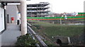
Living in LN2 1DX offers a compact, residential experience shaped by its small cluster of homes and proximity to key services. With a population of 1,813, this area is characterised by a youthful demographic, with the median age at 22 and the majority of residents aged 15–29. The area’s housing stock is dominated by individual homes, reflecting a community that values private living spaces. Despite its modest size, LN2 1DX is strategically positioned near Lincoln’s retail hubs, rail networks, and military infrastructure, including RAF Waddington and Scampton. Daily life here is influenced by its connectivity to nearby towns and cities, with Lincoln Central Railway Station just a short distance away. The area’s low flood risk and absence of environmental constraints make it a practical choice for buyers seeking a balance between affordability and accessibility. However, the high crime risk reported in assessments underscores the need for vigilance. For those prioritising convenience and proximity to services, LN2 1DX presents a straightforward, no-frills option within a larger regional context.
- Area Type
- Postcode
- Area Size
- Not available
- Population
- 1813
- Population Density
- 7551 people/km²
The property market in LN2 1DX is defined by its limited scale and focus on owner-occupied homes. With 34% of residents owning their homes, the area leans more towards private ownership than rental activity, though the small population size means the market is not extensive. The accommodation type is exclusively houses, which contrasts with areas dominated by flats or apartments. This suggests a preference for standalone properties, possibly appealing to those seeking privacy or space. However, the limited number of homes and the area’s small footprint mean buyers must consider nearby regions for more options. For those prioritising a quiet, low-density environment, LN2 1DX offers a niche opportunity, but its restricted size may limit long-term appreciation or development potential.
House Prices in LN2 1DX
No properties found in this postcode.
Energy Efficiency in LN2 1DX
The lifestyle in LN2 1DX is shaped by its proximity to retail, transport, and military facilities. Nearby shops include M&S Lincoln, Tesco Lincoln, and Heron Lincoln, providing access to everyday essentials without requiring long journeys. The area’s rail links to Lincoln Central and surrounding stations make commuting to larger towns straightforward, while the presence of RAF Waddington and Scampton adds a unique dimension to local employment and services. Though the data does not list parks or leisure facilities within the postcode, the surrounding region likely offers recreational options. The combination of retail convenience, transport accessibility, and military infrastructure creates a practical, functional lifestyle. However, the lack of local amenities beyond shopping and transport means residents must look further afield for cultural or leisure activities.
Amenities
Schools
The only named school near LN2 1DX is St Cuthbert’s Nursery School, which provides early education for young children. No primary or secondary schools are listed in the data, meaning families may need to look further afield for comprehensive schooling. The absence of higher-level educational institutions suggests that the area is not ideal for households requiring immediate access to schools beyond nursery level. However, the proximity to Lincoln, a larger town with established schools, may mitigate this limitation. For parents of very young children, the nursery offers a local option, but those with older children will need to factor in travel time to nearby towns. The school’s presence adds a layer of convenience for families with preschool-aged children, though the overall educational infrastructure remains sparse in this specific postcode.
| Rank | School | Type | Entry gender | Ages |
|---|
Explore more schools in this area
Go to Schools tabDemographics
The community in LN2 1DX is overwhelmingly young, with a median age of 22 and 62% of residents falling within the 15–29 age range. This demographic skew suggests a population focused on early career development or education. Home ownership is relatively low at 34%, indicating that a significant portion of the area’s housing is rented. The predominant accommodation type is houses, which aligns with the area’s small, residential character. The ethnic composition is predominantly White, with no specific data provided on other groups. While the data does not include deprivation metrics, the low home ownership rate and youthful population may reflect a transient or student-driven community. This profile suggests a dynamic but potentially unstable housing market, where demand is driven by short-term needs rather than long-term investment.
Household Size
Accommodation Type
Tenure
Ethnic Group
Religion
Household Composition
Age
Household Deprivation
NS-SEC
Explore more demographic insights in this area
Go to Demographics tabPlanning
Planning Constraints
- Flood RiskPremium
- Ramsar Wetland SitesPremium
- Area of Outstanding Natural BeautyPremium
- Protected Nature ReservePremium
- Protected WoodlandPremium