Area Overview for LN13 9RJ
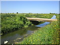
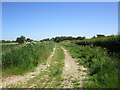
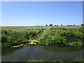
Photos of LN13 9RJ
Area Information
LN13 9RJ is a small residential cluster in England, covering 1.5 km² with a population of 1,374 people. The area’s low density—41 people per square kilometre—suggests a quiet, spread-out community. This postcode is home to a mature demographic, with a median age of 47 and most residents aged 30–64. Daily life here is likely defined by a mix of local amenities and a focus on stability, given the high home ownership rate of 82%. The area is dominated by houses rather than flats, indicating a preference for family-friendly, standalone properties. While it lacks major urban infrastructure, its compact size means residents are likely close to essential services. The presence of two primary schools within reach adds to its appeal for families. However, the area’s small footprint means it is not a hub for nightlife or large-scale retail, making it ideal for those prioritising a peaceful, low-density lifestyle over convenience-driven urban living.
- Area Type
- Postcode
- Area Size
- 1.5 km²
- Population
- 1374
- Population Density
- 41 people/km²
The property market in LN13 9RJ is dominated by owner-occupied homes, with 82% of residents living in properties they own. This high home ownership rate indicates a stable, long-term community with little turnover. The area is primarily composed of houses rather than flats, which is typical of smaller rural or semi-rural postcode areas. This suggests a focus on family-friendly housing with more space and privacy than urban developments. For buyers, this means the market is likely to feature larger properties, though the small area size—just 1.5 km²—means the selection is limited. Prospective buyers should consider the area’s proximity to essential services and schools, as well as its low population density, which may appeal to those seeking a quiet, low-pressure environment. The lack of rental properties also implies a community prioritising permanence over flexibility.
House Prices in LN13 9RJ
Showing 6 properties
| Address | Type | Beds | Baths | Last Sale Price | Last Sale Date | |
|---|---|---|---|---|---|---|
| Sarras Cottage, Mill Lane, Huttoft, LN13 9RJ | house | - | - | £39,600 | Sep 1999 | |
| Dunsmore Cottage, Mill Lane, Huttoft, LN13 9RJ | Semi-detached | 2 | - | - | - | |
| Church View Cottage, Mill Lane, Huttoft, LN13 9RJ | Detached | - | - | - | - | |
| The Maples, Mill Lane, Huttoft, LN13 9RJ | Detached | - | - | - | - | |
| The Gatehouse, Mill Lane, Huttoft, LN13 9RJ | Detached | - | - | - | - | |
| Stables And Paddocks Adjacent The Maples, Mill Lane, Huttoft, LN13 9RJ | Equestrian | - | - | - | - |
Energy Efficiency in LN13 9RJ
The lifestyle in LN13 9RJ is shaped by its proximity to five retail venues, including Spar and Co-op Station Road Sutton on. These shops provide access to essentials like groceries, fuel, and convenience items, supporting a basic level of daily convenience. While the data does not mention dining options, parks, or leisure facilities, the presence of multiple retail outlets suggests a community that prioritises practicality over luxury. The small area size means amenities are likely clustered closely, reducing travel time for errands. For residents, this implies a lifestyle focused on simplicity and self-sufficiency, with limited access to cultural or recreational offerings beyond the immediate vicinity. The retail options, though modest, contribute to the area’s character as a functional, low-maintenance environment.
Amenities
Schools
Residents of LN13 9RJ have access to two primary schools within practical reach: Huttoft Primary School and Huttoft Primary & Nursery School. The latter has an Ofsted rating of ‘good’, indicating a reliable educational offering for younger children. The presence of two primary schools suggests a focus on early education, which is beneficial for families with young children. However, the data does not mention secondary schools or higher education institutions, meaning parents may need to look further afield for secondary schooling. The availability of a nursery at one school adds to the area’s appeal for families with very young children. Overall, the school options reflect a community-oriented approach to education, though the lack of secondary provision may be a consideration for those planning for long-term family needs.
| Rank | School | Type | Entry gender | Ages |
|---|
Explore more schools in this area
Go to Schools tabDemographics
The community in LN13 9RJ is predominantly composed of adults aged 30–64, with a median age of 47. This suggests a mature, settled population, likely with established careers and families. Home ownership is high at 82%, reflecting a strong preference for long-term residency over renting. The area is characterised by houses rather than flats, which aligns with the demographic profile of older, family-oriented households. The predominant ethnic group is White, though no specific data on diversity or deprivation is provided. The low population density—41 people per square kilometre—implies a less crowded environment, which may contribute to a slower pace of life. For those considering this area, the demographic makeup suggests a community focused on stability and long-term living, with fewer transient residents.
Household Size
Accommodation Type
Tenure
Ethnic Group
Religion
Household Composition
Age
Household Deprivation
NS-SEC
Explore more demographic insights in this area
Go to Demographics tabPlanning
Planning Constraints
- Flood RiskPremium
- Ramsar Wetland SitesPremium
- Area of Outstanding Natural BeautyPremium
- Protected Nature ReservePremium
- Protected WoodlandPremium