Area Overview for LN12 2PA
Photos of LN12 2PA
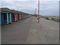
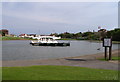


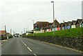
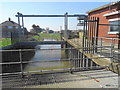


81 photos from this area
Area Information
Key information about the LN12 2PA including its size, population, and administrative classification.
- Area Type
- Postcode
- Area Size
- 7.3 hectares
- Population
- 2069
- Population Density
- 253 people/km²
House Prices in LN12 2PA
34
Properties
£82,606
Average Sold Price
£23,000
Lowest Price
£210,000
Highest Price
Showing 34 properties
| Address | Type | Beds | Baths | Last Sale Price | Last Sale Date | |
|---|---|---|---|---|---|---|
| 4, Tudor Court, Seaholme Road, Mablethorpe, LN12 2PA | Flat | - | - | £74,000 | Apr 2024 | |
| Rowan Cottage, Seaholme Road, Mablethorpe, LN12 2PA | Bungalow | - | - | £210,000 | Aug 2022 | |
| 1, Tudor Court, Seaholme Road, Mablethorpe, LN12 2PA | Flat | - | - | £89,950 | Aug 2021 | |
| 3, Ocean Court, Seaholme Road, Mablethorpe, LN12 2PA | house | - | - | £78,000 | Feb 2021 | |
| 1, Ocean Court, Seaholme Road, Mablethorpe, LN12 2PA | Semi-detached | 7 | 4 | £132,000 | May 2019 | |
| 4, Ocean Court, Seaholme Road, Mablethorpe, LN12 2PA | Terraced | 2 | 1 | £88,000 | Aug 2017 | |
| 5A Seaholme Road, Mablethorpe, LN12 2PA | Bungalow | 2 | - | £60,000 | May 2014 | |
| Memories, Seaholme Road, Mablethorpe, LN12 2PA | Bungalow | - | - | £120,000 | Sep 2011 | |
| 3, Tudor Court, Seaholme Road, Mablethorpe, LN12 2PA | Flat | - | - | £63,000 | Jul 2011 | |
| 2, Tudor Court, Seaholme Road, Mablethorpe, LN12 2PA | Flat | - | - | £70,000 | Jun 2007 |
Page 1 of 4
Energy Efficiency in LN12 2PA
Amenities
Schools
| Rank | School | Type | Entry gender | Ages |
|---|
Explore more schools in this area
Go to Schools tabDemographics
Household Size
Two person
most common
Accommodation Type
Houses
most common
Tenure
77
majority
Ethnic Group
White
most common
Religion
N/A
most common
Household Composition
N/A
most common
Age
47
median
Elderly (65+ years)
most common
Household Deprivation
N/A
with no deprivation
NS-SEC
17
in Lower managerial occupations
Explore more demographic insights in this area
Go to Demographics tabPlanning
Planning Constraints
- Flood RiskPremium
- Ramsar Wetland SitesPremium
- Area of Outstanding Natural BeautyPremium
- Protected Nature ReservePremium
- Protected WoodlandPremium