Area Overview for LN12 1PZ
Photos of LN12 1PZ
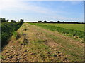
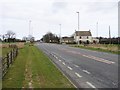
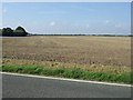
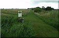
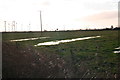
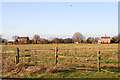
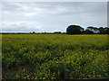
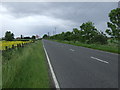
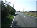
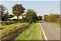
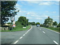

12 photos from this area
Area Information
Key information about the LN12 1PZ including its size, population, and administrative classification.
- Area Type
- Postcode
- Area Size
- 1.1 km²
- Population
- 2161
- Population Density
- 292 people/km²
House Prices in LN12 1PZ
13
Properties
£209,167
Average Sold Price
£30,000
Lowest Price
£360,000
Highest Price
Showing 13 properties
| Address | Type | Beds | Baths | Last Sale Price | Last Sale Date | |
|---|---|---|---|---|---|---|
| Sherwood Lodge, Theddlethorpe Road, Mablethorpe, LN12 1PZ | Detached | 3 | - | £360,000 | Sep 2021 | |
| Eastfield House, Theddlethorpe Road, Mablethorpe, LN12 1PZ | Detached | 3 | 2 | £237,500 | Dec 2015 | |
| Former Laburnum House, Theddlethorpe Road, Mablethorpe, LN12 1PZ | Detached | - | - | £30,000 | Aug 1996 | |
| Brook Cottage, Theddlethorpe Road, Mablethorpe, LN12 1PZ | house | - | - | - | - | |
| Standen Lodge, Theddlethorpe Road, Mablethorpe, LN12 1PZ | Bungalow | - | - | - | - | |
| Poplar Farm, Theddlethorpe Road, Mablethorpe, LN12 1PZ | Farm | - | - | - | - | |
| The Homestead, Theddlethorpe Road, Mablethorpe, LN12 1PZ | Detached | - | - | - | - | |
| Caravan At, Eastfield House, Theddlethorpe Road, Mablethorpe, LN12 1PZ | Mobile Home | - | - | - | - | |
| Beulahland, Theddlethorpe Road, Mablethorpe, LN12 1PZ | Detached | - | - | - | - | |
| Caravan 2, Rose Cottage, Theddlethorpe Road, Mablethorpe, LN12 1PZ | Mobile Home | - | - | - | - |
Page 1 of 2
Energy Efficiency in LN12 1PZ
Amenities
Schools
| Rank | School | Type | Entry gender | Ages |
|---|
Explore more schools in this area
Go to Schools tabDemographics
Household Size
Two person
most common
Accommodation Type
Houses
most common
Tenure
73
majority
Ethnic Group
White
most common
Religion
N/A
most common
Household Composition
N/A
most common
Age
47
median
Adults (30-64 years)
most common
Household Deprivation
N/A
with no deprivation
NS-SEC
14
in Lower managerial occupations
Explore more demographic insights in this area
Go to Demographics tabPlanning
Planning Constraints
- Flood RiskPremium
- Ramsar Wetland SitesPremium
- Area of Outstanding Natural BeautyPremium
- Protected Nature ReservePremium
- Protected WoodlandPremium