Area Overview for LN12 1PQ
Photos of LN12 1PQ
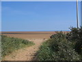
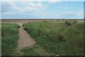
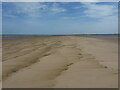
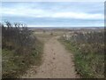
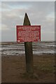
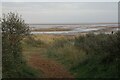

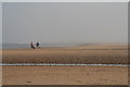
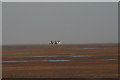


20 photos from this area
Area Information
Key information about the LN12 1PQ including its size, population, and administrative classification.
- Area Type
- Postcode
- Area Size
- 2.7 km²
- Population
- 2027
- Population Density
- 33 people/km²
House Prices in LN12 1PQ
20
Properties
£124,500
Average Sold Price
£28,000
Lowest Price
£203,000
Highest Price
Showing 20 properties
| Address | Type | Beds | Baths | Last Sale Price | Last Sale Date | |
|---|---|---|---|---|---|---|
| 1, Coastguard Cottages, Churchill Lane, Theddlethorpe, LN12 1PQ | house | - | - | £160,000 | Mar 2025 | |
| 2, Coastguard Cottages, Churchill Lane, Theddlethorpe, LN12 1PQ | house | - | - | £140,000 | Dec 2021 | |
| Sea Shadow, Churchill Lane, Theddlethorpe, LN12 1PQ | Bungalow | 3 | - | £150,000 | Jan 2014 | |
| Sunny Bank, Churchill Lane, Theddlethorpe, LN12 1PQ | Detached | - | - | £28,000 | Nov 2013 | |
| The Mead, Churchill Lane, Theddlethorpe, LN12 1PQ | Semi-detached | - | - | £66,000 | Dec 2002 | |
| Sea Bank Farm, Churchill Lane, Theddlethorpe, LN12 1PQ | house | - | - | £203,000 | Jun 2001 | |
| Woodville, Churchill Lane, Theddlethorpe, LN12 1PQ | Land | - | - | - | - | |
| The Elders, Churchill Lane, Theddlethorpe, LN12 1PQ | Equestrian | 3 | 1 | - | - | |
| 3, Coastguard Cottages, Churchill Lane, Theddlethorpe, LN12 1PQ | house | - | - | - | - | |
| Cabin At, Sunny Bank, Churchill Lane, Theddlethorpe, LN12 1PQ | Mobile Home | - | - | - | - |
Page 1 of 2
Energy Efficiency in LN12 1PQ
Amenities
Schools
| Rank | School | Type | Entry gender | Ages |
|---|
Explore more schools in this area
Go to Schools tabDemographics
Household Size
Two person
most common
Accommodation Type
Houses
most common
Tenure
84
majority
Ethnic Group
White
most common
Religion
N/A
most common
Household Composition
N/A
most common
Age
47
median
Adults (30-64 years)
most common
Household Deprivation
N/A
with no deprivation
NS-SEC
28
in Lower managerial occupations
Explore more demographic insights in this area
Go to Demographics tabPlanning
Planning Constraints
- Flood RiskPremium
- Ramsar Wetland SitesPremium
- Area of Outstanding Natural BeautyPremium
- Protected Nature ReservePremium
- Protected WoodlandPremium