Area Overview for LN11 7ST
Photos of LN11 7ST
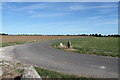
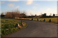
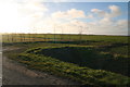
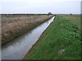
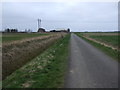
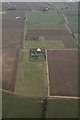
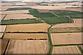
11 photos from this area
Area Information
Key information about the LN11 7ST including its size, population, and administrative classification.
- Area Type
- Postcode
- Area Size
- 1.2 km²
- Population
- 2027
- Population Density
- 33 people/km²
House Prices in LN11 7ST
11
Properties
£257,815
Average Sold Price
£162,000
Lowest Price
£375,000
Highest Price
Showing 11 properties
| Address | Type | Beds | Baths | Last Sale Price | Last Sale Date | |
|---|---|---|---|---|---|---|
| Ballaspur, Ings Lane, Saltfleetby, LN11 7ST | Detached | 4 | 3 | £375,000 | Jul 2025 | |
| Sandilands, Ings Lane, Saltfleetby, LN11 7ST | Bungalow | 3 | 2 | £250,000 | Feb 2020 | |
| Wayside, Ings Lane, Saltfleetby, LN11 7ST | Bungalow | 3 | - | £212,075 | Jun 2018 | |
| Inglenook, Ings Lane, Saltfleetby, LN11 7ST | Bungalow | 3 | - | £290,000 | Nov 2015 | |
| The Retreat, Ings Lane, Saltfleetby, LN11 7ST | Bungalow | 2 | - | £162,000 | Mar 2011 | |
| New Bungalow, Ings Lane Workshop, Ings Lane, Saltfleetby, LN11 7ST | Bungalow | 3 | - | - | - | |
| Norton Lodge, Ings Lane, Saltfleetby, LN11 7ST | Bungalow | - | - | - | - | |
| Cenarth, Ings Lane, Saltfleetby, LN11 7ST | Bungalow | - | - | - | - | |
| Ings Farm, Ings Lane, Saltfleetby, LN11 7ST | house | - | - | - | - | |
| Sykes View, Ings Lane, Saltfleetby, LN11 7ST | Bungalow | - | - | - | - |
Page 1 of 2
Energy Efficiency in LN11 7ST
Amenities
Schools
| Rank | School | Type | Entry gender | Ages |
|---|
Explore more schools in this area
Go to Schools tabDemographics
Household Size
Two person
most common
Accommodation Type
Houses
most common
Tenure
84
majority
Ethnic Group
White
most common
Religion
N/A
most common
Household Composition
N/A
most common
Age
47
median
Adults (30-64 years)
most common
Household Deprivation
N/A
with no deprivation
NS-SEC
28
in Lower managerial occupations
Explore more demographic insights in this area
Go to Demographics tabPlanning
Planning Constraints
- Flood RiskPremium
- Ramsar Wetland SitesPremium
- Area of Outstanding Natural BeautyPremium
- Protected Nature ReservePremium
- Protected WoodlandPremium