Area Overview for LN11 7PE
Photos of LN11 7PE
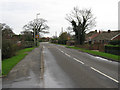
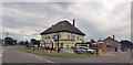
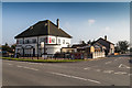
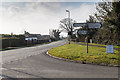
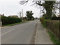
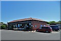
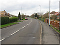
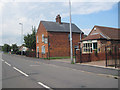
24 photos from this area
Area Information
Key information about the LN11 7PE including its size, population, and administrative classification.
- Area Type
- Postcode
- Area Size
- 6.3 hectares
- Population
- 1939
- Population Density
- 51 people/km²
House Prices in LN11 7PE
40
Properties
£106,158
Average Sold Price
£38,450
Lowest Price
£200,000
Highest Price
Showing 40 properties
| Address | Type | Beds | Baths | Last Sale Price | Last Sale Date | |
|---|---|---|---|---|---|---|
| 42 Evison Way, North Somercotes, LN11 7PE | Semi-detached | 2 | 1 | £110,000 | Oct 2025 | |
| 56 Evison Way, North Somercotes, LN11 7PE | house | 3 | 1 | £135,000 | Oct 2024 | |
| 19 Evison Way, North Somercotes, LN11 7PE | Bungalow | 3 | 1 | £195,000 | Dec 2022 | |
| 3 Evison Way, North Somercotes, LN11 7PE | Bungalow | - | - | £200,000 | Aug 2021 | |
| 22 Evison Way, North Somercotes, LN11 7PE | Bungalow | 3 | 1 | £149,950 | Sep 2019 | |
| 52 Evison Way, North Somercotes, LN11 7PE | Semi-detached | 3 | 1 | £119,950 | Aug 2019 | |
| 46 Evison Way, North Somercotes, LN11 7PE | Detached | 3 | 1 | £105,000 | Feb 2019 | |
| 48 Evison Way, North Somercotes, LN11 7PE | Semi-detached | 2 | - | £112,000 | Oct 2018 | |
| 38 Evison Way, North Somercotes, LN11 7PE | Semi-detached | 2 | 1 | £104,000 | Aug 2018 | |
| 7 Evison Way, North Somercotes, LN11 7PE | house | - | - | £143,000 | Nov 2017 |
Page 1 of 4
Energy Efficiency in LN11 7PE
Amenities
Schools
| Rank | School | Type | Entry gender | Ages |
|---|
Explore more schools in this area
Go to Schools tabDemographics
Household Size
Two person
most common
Accommodation Type
Houses
most common
Tenure
80
majority
Ethnic Group
White
most common
Religion
N/A
most common
Household Composition
N/A
most common
Age
47
median
Adults (30-64 years)
most common
Household Deprivation
N/A
with no deprivation
NS-SEC
24
in Lower managerial occupations
Explore more demographic insights in this area
Go to Demographics tabPlanning
Planning Constraints
- Flood RiskPremium
- Ramsar Wetland SitesPremium
- Area of Outstanding Natural BeautyPremium
- Protected Nature ReservePremium
- Protected WoodlandPremium