Area Overview for LN11 7AE
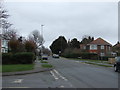
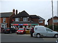
Photos of LN11 7AE


Area Information
Living in LN11 7AE offers a quiet, compact residential experience typical of a small cluster of homes in England. With a population of 2,475, the area feels intimate, catering to those who value a slower pace of life. The community is predominantly composed of adults aged 30–64, reflecting a mature demographic that likely includes families and long-term residents. The area’s housing stock is largely made up of houses, which suggests a more traditional, suburban layout compared to high-density developments. Digital connectivity is strong, with broadband scores rated excellent and mobile coverage good, supporting both daily internet use and remote work. Nearby retail options like Spar, Aldi, and Lincolnshire Co-operative Co provide convenience for essentials. While the area lacks major natural or environmental constraints, its low flood risk and absence of protected sites make it a practical choice for those prioritising stability. LN11 7AE is ideal for buyers seeking a small, well-connected community with a balance of practicality and comfort.
- Area Type
- Postcode
- Area Size
- Not available
- Population
- 2475
- Population Density
- 4850 people/km²
The property market in LN11 7AE reflects a balance between owner-occupied and rental homes, with 49% of residents owning their properties. The area’s housing stock is predominantly composed of houses, which may appeal to those seeking larger, more traditional homes compared to high-density developments. This mix of ownership and rental properties suggests a moderate market, neither dominated by speculative investment nor entirely reliant on long-term tenants. For buyers, the focus on houses implies limited availability of flats or apartments, which could be a consideration for those prioritising different housing types. The small size of the area means the immediate surroundings may offer similar options, but the overall market is likely tight. Given the age profile of residents, properties here may cater to families or individuals looking for stable, low-maintenance homes.
House Prices in LN11 7AE
No properties found in this postcode.
Energy Efficiency in LN11 7AE
The lifestyle in LN11 7AE is shaped by its proximity to essential retail amenities, including Spar, Lincolnshire Co-operative Co, and Aldi Louth. These shops provide easy access to groceries, household goods, and other daily necessities, reducing the need for long commutes to larger centres. While the area lacks detailed information on parks or leisure facilities, the presence of multiple retail options implies a focus on practicality and convenience. The small cluster of homes fosters a close-knit community feel, where local shops and familiar faces contribute to a sense of belonging. For those who prioritise accessibility over sprawling recreational spaces, LN11 7AE offers a straightforward, no-frills lifestyle with minimal effort required to meet everyday needs.
Amenities
Schools
| Rank | School | Type | Entry gender | Ages |
|---|
Explore more schools in this area
Go to Schools tabDemographics
The community in LN11 7AE is characterised by a median age of 47, with the most common age range being adults aged 30–64. This suggests a population skewed towards middle-aged individuals, likely including families and professionals in their prime working years. Home ownership stands at 49%, meaning nearly half of residents rent their homes. The area’s accommodation is predominantly houses, indicating a focus on single-family dwellings rather than flats or apartments. The predominant ethnic group is White, though no further breakdown of diversity is provided. With a population of 2,475, the area is small enough to foster a close-knit community but not so dense as to feel overcrowded. The age profile and home ownership figures suggest a mix of long-term residents and those seeking stable, low-maintenance housing.
Household Size
Accommodation Type
Tenure
Ethnic Group
Religion
Household Composition
Age
Household Deprivation
NS-SEC
Explore more demographic insights in this area
Go to Demographics tabPlanning
Planning Constraints
- Flood RiskPremium
- Ramsar Wetland SitesPremium
- Area of Outstanding Natural BeautyPremium
- Protected Nature ReservePremium
- Protected WoodlandPremium