Area Overview for LN11 0QJ
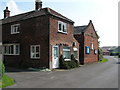
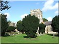
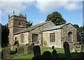
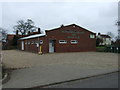
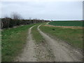
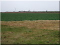
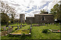
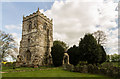
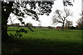
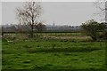
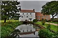
Photos of LN11 0QJ

Area Information
Living in LN11 0QJ offers a quiet, low-density residential experience, with a population of 2,265 spread across 38 people per square kilometre. This small postcode area, classified as a residential cluster, feels more like a village than a city suburb. The community is likely to be close-knit, with homes set apart from one another, fostering a sense of privacy. Given the modest population and sparse density, daily life here is likely to be unhurried, with limited noise and traffic. The area’s small size means it is not a commercial hub, but its proximity to nearby towns or cities could provide access to broader amenities. Residents might find themselves relying on nearby settlements for major services, though the immediate environment offers a tranquil alternative to more densely populated regions. The absence of large-scale infrastructure or industrial activity suggests a focus on residential comfort, making it appealing to those seeking a peaceful, low-maintenance lifestyle.
- Area Type
- Postcode
- Area Size
- Not available
- Population
- 2265
- Population Density
- 38 people/km²
LN11 0QJ is predominantly an owner-occupied area, with 82% of homes owned by residents rather than rented. The accommodation type is exclusively houses, which is unusual for areas with higher population density but fits with the low density of 38 people per square kilometre. This suggests a housing stock of detached or semi-detached properties, likely designed for families or individuals seeking space. Given the small size of the postcode area, the property market is limited, meaning buyers may need to consider nearby regions for more options. The focus on owner-occupation implies a long-term investment mindset among residents, though the lack of rental properties could make it less attractive to those seeking flexibility.
House Prices in LN11 0QJ
No properties found in this postcode.
Energy Efficiency in LN11 0QJ
The nearest amenities to LN11 0QJ include five retail outlets, with notable names such as Spar and Lincolnshire Co-operative Co. These shops provide access to everyday essentials, though the variety is limited compared to larger towns. The presence of multiple Spar stores suggests a focus on convenience and local retail, catering to nearby residents’ needs. Beyond retail, the data does not specify parks, dining, or leisure facilities, implying that residents may need to travel to nearby areas for more diverse options. The small number of amenities aligns with the area’s low density, creating a lifestyle that prioritises simplicity and proximity to essential services over a wide range of leisure choices.
Amenities
Schools
Residents of LN11 0QJ have access to two primary schools: Grainthorpe Junior School and Marshchapel Infant School. Both are rated as ‘good’ by Ofsted, indicating a solid standard of education for younger children. The presence of two primary schools suggests the area caters to families with young children, though no secondary schools are listed in the data. This means parents may need to travel to nearby towns for secondary education. The mix of infant and junior schools provides a seamless transition for children, but the absence of higher education facilities within the area is a consideration for families planning long-term stays.
| Rank | School | Type | Entry gender | Ages |
|---|
Explore more schools in this area
Go to Schools tabDemographics
The population of LN11 0QJ is predominantly adults aged 30–64, with a median age of 47. This suggests a mature, stable community, likely with established careers and families. Home ownership is high, at 82%, indicating a strong preference for long-term residency rather than rental properties. The accommodation type is primarily houses, which aligns with the area’s low density and likely semi-detached or detached housing stock. The predominant ethnic group is White, reflecting a homogenous demographic profile. While no specific deprivation data is provided, the high home ownership rate and age profile imply a relatively stable economic environment. However, the absence of detailed diversity metrics means the community’s social composition remains largely unexplored in the data.
Household Size
Accommodation Type
Tenure
Ethnic Group
Religion
Household Composition
Age
Household Deprivation
NS-SEC
Explore more demographic insights in this area
Go to Demographics tabPlanning
Planning Constraints
- Flood RiskPremium
- Ramsar Wetland SitesPremium
- Area of Outstanding Natural BeautyPremium
- Protected Nature ReservePremium
- Protected WoodlandPremium