Area Overview for LN11 0JZ
Photos of LN11 0JZ
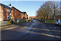
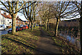
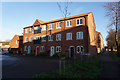
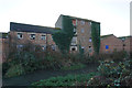
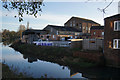


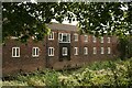
48 photos from this area
Area Information
Key information about the LN11 0JZ including its size, population, and administrative classification.
- Area Type
- Postcode
- Area Size
- 4616 m²
- Population
- 1091
- Population Density
- 3431 people/km²
House Prices in LN11 0JZ
18
Properties
£95,747
Average Sold Price
£33,000
Lowest Price
£197,500
Highest Price
Showing 18 properties
| Address | Type | Beds | Baths | Last Sale Price | Last Sale Date | |
|---|---|---|---|---|---|---|
| 44 Leakes Row, Louth, LN11 0JZ | Bungalow | 3 | 1 | £197,500 | May 2023 | |
| 40 Leakes Row, Louth, LN11 0JZ | Terraced | 2 | 1 | £130,000 | May 2022 | |
| 41 Leakes Row, Louth, LN11 0JZ | Terraced | 2 | 1 | £120,000 | Mar 2019 | |
| 28 Leakes Row, Louth, LN11 0JZ | Terraced | 3 | 1 | £135,000 | Mar 2019 | |
| 35 Leakes Row, Louth, LN11 0JZ | Terraced | 2 | 1 | £106,000 | Apr 2018 | |
| 43 Leakes Row, Louth, LN11 0JZ | Terraced | 2 | 1 | £123,000 | Jul 2017 | |
| 34 Leakes Row, Louth, LN11 0JZ | Terraced | 2 | 1 | £85,500 | Mar 2015 | |
| 37 Leakes Row, Louth, LN11 0JZ | Terraced | 2 | 1 | £95,000 | Dec 2014 | |
| 30 Leakes Row, Louth, LN11 0JZ | Terraced | - | - | £124,000 | Feb 2007 | |
| 42 Leakes Row, Louth, LN11 0JZ | Terraced | 2 | 1 | £72,000 | Jun 2005 |
Page 1 of 2
Energy Efficiency in LN11 0JZ
Amenities
Schools
| Rank | School | Type | Entry gender | Ages |
|---|
Explore more schools in this area
Go to Schools tabDemographics
Household Size
One person
most common
Accommodation Type
Houses
most common
Tenure
56
majority
Ethnic Group
White
most common
Religion
N/A
most common
Household Composition
N/A
most common
Age
47
median
Adults (30-64 years)
most common
Household Deprivation
N/A
with no deprivation
NS-SEC
21
in Lower managerial occupations
Explore more demographic insights in this area
Go to Demographics tabPlanning
Planning Constraints
- Flood RiskPremium
- Ramsar Wetland SitesPremium
- Area of Outstanding Natural BeautyPremium
- Protected Nature ReservePremium
- Protected WoodlandPremium