Area Overview for LN10 6TD
Photos of LN10 6TD
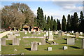
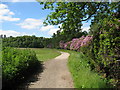


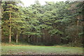
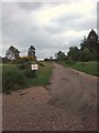
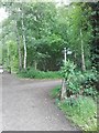
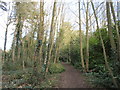


35 photos from this area
Area Information
Key information about the LN10 6TD including its size, population, and administrative classification.
- Area Type
- Postcode
- Area Size
- 2.5 hectares
- Population
- 1120
- Population Density
- 121 people/km²
House Prices in LN10 6TD
22
Properties
£321,841
Average Sold Price
£165,000
Lowest Price
£516,000
Highest Price
Showing 22 properties
| Address | Type | Beds | Baths | Last Sale Price | Last Sale Date | |
|---|---|---|---|---|---|---|
| Birchwood, 18 Tor O Moor Road, Woodhall Spa, LN10 6TD | Bungalow | 3 | 1 | £345,000 | Dec 2024 | |
| 40 Tor O Moor Road, Woodhall Spa, LN10 6TD | Bungalow | 3 | 3 | £516,000 | Mar 2021 | |
| Antares, 26 Tor O Moor Road, Woodhall Spa, LN10 6TD | Bungalow | - | - | £350,000 | Jan 2021 | |
| Kantara, 31 Tor O Moor Road, Woodhall Spa, LN10 6TD | Bungalow | - | - | £320,000 | Sep 2018 | |
| St Clare, 24 Tor O Moor Road, Woodhall Spa, LN10 6TD | Bungalow | - | - | £400,000 | May 2018 | |
| 34 Tor O Moor Road, Woodhall Spa, LN10 6TD | house | 4 | 2 | £440,000 | Jan 2018 | |
| Pinebeck, 22 Tor O Moor Road, Woodhall Spa, LN10 6TD | house | - | - | £350,000 | Oct 2017 | |
| 20 Tor O Moor Road, Woodhall Spa, LN10 6TD | Bungalow | 3 | - | £239,950 | Oct 2015 | |
| 35 Tor O Moor Road, Woodhall Spa, LN10 6TD | Bungalow | 3 | - | £275,000 | Sep 2014 | |
| Kingthorpe Lodge, 39 Tor O Moor Road, Woodhall Spa, LN10 6TD | Semi-detached | 4 | - | £250,000 | Mar 2014 |
Page 1 of 3
Energy Efficiency in LN10 6TD
Amenities
Schools
| Rank | School | Type | Entry gender | Ages |
|---|
Explore more schools in this area
Go to Schools tabDemographics
Household Size
Two person
most common
Accommodation Type
Houses
most common
Tenure
88
majority
Ethnic Group
White
most common
Religion
N/A
most common
Household Composition
N/A
most common
Age
47
median
Elderly (65+ years)
most common
Household Deprivation
N/A
with no deprivation
NS-SEC
43
in Lower managerial occupations
Explore more demographic insights in this area
Go to Demographics tabPlanning
Planning Constraints
- Flood RiskPremium
- Ramsar Wetland SitesPremium
- Area of Outstanding Natural BeautyPremium
- Protected Nature ReservePremium
- Protected WoodlandPremium