Area Overview for LN10 6SA
Photos of LN10 6SA
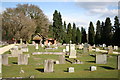
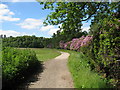
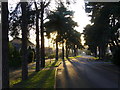
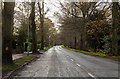
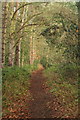
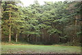
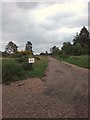
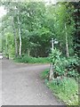


35 photos from this area
Area Information
Key information about the LN10 6SA including its size, population, and administrative classification.
- Area Type
- Postcode
- Area Size
- 7039 m²
- Population
- 1496
- Population Density
- 961 people/km²
House Prices in LN10 6SA
12
Properties
£203,313
Average Sold Price
£30,000
Lowest Price
£325,000
Highest Price
Showing 12 properties
| Address | Type | Beds | Baths | Last Sale Price | Last Sale Date | |
|---|---|---|---|---|---|---|
| Oak Lodge, 20 Kirkby Lane, Woodhall Spa, LN10 6SA | Bungalow | 3 | 1 | £325,000 | Oct 2024 | |
| 8 Kirkby Lane, Woodhall Spa, LN10 6SA | Terraced | 3 | 1 | £292,000 | Sep 2023 | |
| Linglea, 10 Kirkby Lane, Woodhall Spa, LN10 6SA | house | 3 | 1 | £202,000 | Jun 2023 | |
| 2 Kirkby Lane, Woodhall Spa, LN10 6SA | house | - | - | £225,000 | Mar 2023 | |
| 14 Kirkby Lane, Woodhall Spa, LN10 6SA | Semi-detached | 3 | 1 | £162,500 | Dec 2014 | |
| 22 Kirkby Lane, Woodhall Spa, LN10 6SA | Bungalow | - | - | £250,000 | Nov 2011 | |
| 18 Kirkby Lane, Woodhall Spa, LN10 6SA | Bungalow | - | - | £140,000 | Aug 2009 | |
| 16 Kirkby Lane, Woodhall Spa, LN10 6SA | Semi-detached | - | - | £30,000 | Sep 1996 | |
| 4 Kirkby Lane, Woodhall Spa, LN10 6SA | Terraced | - | - | - | - | |
| Gorselea, 6 Kirkby Lane, Woodhall Spa, LN10 6SA | house | - | - | - | - |
Page 1 of 2
Energy Efficiency in LN10 6SA
Amenities
Schools
| Rank | School | Type | Entry gender | Ages |
|---|
Explore more schools in this area
Go to Schools tabDemographics
Household Size
One person
most common
Accommodation Type
Houses
most common
Tenure
63
majority
Ethnic Group
White
most common
Religion
N/A
most common
Household Composition
N/A
most common
Age
47
median
Adults (30-64 years)
most common
Household Deprivation
N/A
with no deprivation
NS-SEC
34
in Lower managerial occupations
Explore more demographic insights in this area
Go to Demographics tabPlanning
Planning Constraints
- Flood RiskPremium
- Ramsar Wetland SitesPremium
- Area of Outstanding Natural BeautyPremium
- Protected Nature ReservePremium
- Protected WoodlandPremium