Area Overview for LN1 3UW
Photos of LN1 3UW
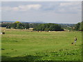
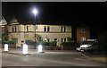
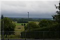
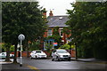
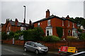
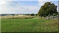
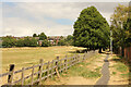
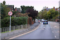
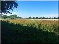
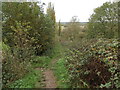
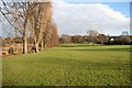
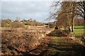
30 photos from this area
Area Information
Key information about the LN1 3UW including its size, population, and administrative classification.
- Area Type
- Postcode
- Area Size
- 3.0 hectares
- Population
- 2486
- Population Density
- 725 people/km²
House Prices in LN1 3UW
48
Properties
£221,539
Average Sold Price
£33,950
Lowest Price
£425,000
Highest Price
Showing 48 properties
| Address | Type | Beds | Baths | Last Sale Price | Last Sale Date | |
|---|---|---|---|---|---|---|
| 318 Burton Road, Lincoln, LN1 3UW | Semi-detached | 2 | 1 | £223,000 | Dec 2024 | |
| 322 Burton Road, Lincoln, LN1 3UW | Detached | 3 | 1 | £358,000 | May 2023 | |
| 326 Burton Road, Lincoln, LN1 3UW | Detached | 3 | 1 | £360,000 | Mar 2023 | |
| 324 Burton Road, Lincoln, LN1 3UW | Bungalow | 3 | 1 | £277,000 | Dec 2022 | |
| 294 Burton Road, Lincoln, LN1 3UW | Terraced | 1 | 1 | £250,000 | Sep 2022 | |
| 302 Burton Road, Lincoln, LN1 3UW | Terraced | 3 | 2 | £250,000 | Apr 2022 | |
| 272 Burton Road, Lincoln, LN1 3UW | Maisonette | - | - | £115,000 | Feb 2021 | |
| 298 Burton Road, Lincoln, LN1 3UW | Bungalow | 3 | 2 | £330,000 | Nov 2020 | |
| 328 Burton Road, Lincoln, LN1 3UW | Detached | 4 | 2 | £425,000 | Dec 2018 | |
| 306 Burton Road, Lincoln, LN1 3UW | Detached | 4 | 2 | £310,000 | Aug 2018 |
Page 1 of 5
Energy Efficiency in LN1 3UW
Amenities
Schools
| Rank | School | Type | Entry gender | Ages |
|---|
Explore more schools in this area
Go to Schools tabDemographics
Household Size
Two person
most common
Accommodation Type
Houses
most common
Tenure
70
majority
Ethnic Group
White
most common
Religion
N/A
most common
Household Composition
N/A
most common
Age
47
median
Adults (30-64 years)
most common
Household Deprivation
N/A
with no deprivation
NS-SEC
45
in Lower managerial occupations
Explore more demographic insights in this area
Go to Demographics tabPlanning
Planning Constraints
- Flood RiskPremium
- Ramsar Wetland SitesPremium
- Area of Outstanding Natural BeautyPremium
- Protected Nature ReservePremium
- Protected WoodlandPremium