Area Overview for LN1 2ZF
Photos of LN1 2ZF


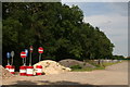
15 photos from this area
Area Information
Key information about the LN1 2ZF including its size, population, and administrative classification.
- Area Type
- Postcode
- Area Size
- 12.5 hectares
- Population
- 1205
- Population Density
- 40 people/km²
House Prices in LN1 2ZF
32
Properties
£390,807
Average Sold Price
£295,000
Lowest Price
£485,000
Highest Price
Showing 32 properties
| Address | Type | Beds | Baths | Last Sale Price | Last Sale Date | |
|---|---|---|---|---|---|---|
| 28 Woodlands Edge, North Carlton, Lincoln, LN1 2ZF | house | - | - | £470,000 | Jul 2022 | |
| 14 Woodlands Edge, North Carlton, Lincoln, LN1 2ZF | house | - | - | £449,525 | Sep 2021 | |
| 29 Woodlands Edge, North Carlton, Lincoln, LN1 2ZF | house | - | - | £480,000 | Jun 2021 | |
| 17 Woodlands Edge, North Carlton, Lincoln, LN1 2ZF | house | - | - | £375,000 | May 2021 | |
| 26 Woodlands Edge, North Carlton, Lincoln, LN1 2ZF | house | 4 | 3 | £480,000 | Apr 2021 | |
| 15 Woodlands Edge, North Carlton, Lincoln, LN1 2ZF | Semi-detached | 4 | 2 | £390,000 | Apr 2021 | |
| 25 Woodlands Edge, North Carlton, Lincoln, LN1 2ZF | house | 4 | 3 | £485,000 | Apr 2021 | |
| 23 Woodlands Edge, North Carlton, Lincoln, LN1 2ZF | house | - | - | £298,000 | Apr 2021 | |
| 24 Woodlands Edge, North Carlton, Lincoln, LN1 2ZF | Bungalow | 2 | 2 | £320,000 | Aug 2020 | |
| 20 Woodlands Edge, North Carlton, Lincoln, LN1 2ZF | house | - | - | £325,000 | Dec 2019 |
Page 1 of 4
Energy Efficiency in LN1 2ZF
Amenities
Schools
| Rank | School | Type | Entry gender | Ages |
|---|
Explore more schools in this area
Go to Schools tabDemographics
Household Size
Two person
most common
Accommodation Type
Houses
most common
Tenure
75
majority
Ethnic Group
White
most common
Religion
N/A
most common
Household Composition
N/A
most common
Age
47
median
Adults (30-64 years)
most common
Household Deprivation
N/A
with no deprivation
NS-SEC
49
in Lower managerial occupations
Explore more demographic insights in this area
Go to Demographics tabPlanning
Planning Constraints
- Flood RiskPremium
- Ramsar Wetland SitesPremium
- Area of Outstanding Natural BeautyPremium
- Protected Nature ReservePremium
- Protected WoodlandPremium