Area Overview for Little Stanion
Photos of Little Stanion
Area Information
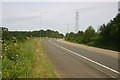
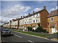
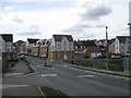
Living in Little Stanion means residing within a unique civil parish in North Northamptonshire, officially established as an independent area on 1 April 2018. You will find a modern housing estate that functions as a village, situated on the edge of Rockingham Forest. This 1.2 km² development lies 1.1 miles southeast of Corby town centre and 7 miles from Kettering. Neighbouring villages include Stanion, Brigstock, and Geddington. The estate itself is a privately owned and managed development controlled by the Little Stanion Farm Management Company. Access is restricted to a single route from the A43/A6116 roundabout. Construction of the first homes began in 2008, with 733 properties completed by October 2016. Plans exist for up to 970 additional homes. Residents benefit from an integrated layout featuring 37 acres of parkland, 3.5 km of paths, an outdoor gym, and two children's play parks. A primary school opened in 2012 to serve the community. Life here revolves around this comprehensive suburban design, intended to foster a community spirit through organisational groups like the Little Stanion Village Association, which was founded in 2011 to represent residents and host local events.
- Area Type
- Parish
- Area Size
- 1.2 km²
- Population
- Not available
- Population Density
- Not available
Demographics
The demographic profile of Little Stanion reflects a predominantly older population, with a median age of 70 years. This indicates that households are likely dominated by retirees or long-term residents seeking a quiet retirement setting rather than young families building careers. The age data categorises the total population under the heading of Age: Total, confirming this broad spread. Home ownership is exceptionally high within these boundaries, standing at 76%. This figure places the area well above average for housing affordability markets where rentals dominate. Such a high ownership rate typically correlates with stability and residents who have lived there for many years. There is no indication of significant demographic shifts or influxes of younger workers into the immediate vicinity. The area does not provide specific breakdowns for ethnic groups, religious affiliations, or detailed household composition metrics beyond the total counts. This lack of granular social data suggests a community that has developed organically rather than through rapid regeneration. The overall picture paints a static, mature neighbourhood where the primary social dynamic is based on established neighbourly ties rather than transient or mixed-age interactions.
Household Size
Accommodation Type
Tenure
Ethnic Group
Religion
Household Composition
Age
Household Deprivation
NS-SEC
Explore more demographic insights in this area
Go to Demographics tabPlanning
Planning Constraints
- Flood RiskPremium
- Ramsar Wetland SitesPremium
- Area of Outstanding Natural BeautyPremium
- Protected Nature ReservePremium
- Crime RiskPremium