Area Overview for Little Longstone
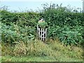
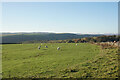
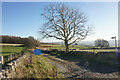
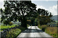
Photos of Little Longstone


Area Information
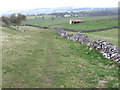
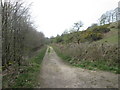
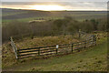
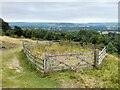
Living in Little Longstone offers a quiet retreat within a civil parish that spans just 4.2 square kilometres. You will find yourself in a tightly knit environment where the landscape dictates daily life. This compact footprint means distances are short, fostering a close-knit community feel among residents. The area does not contain any Ramsar wetland sites or Areas of Outstanding Natural Beauty, yet it does hold protected nature reserves and protected woodland within its boundaries. These designations suggest a setting where conservation remains a priority alongside domestic development. The demographic profile reveals a village largely populated by retirees and those seeking a slower pace compared to larger towns. Understanding the sheer scale of the parish helps shape your expectations; it is a small, defined space rather than a sprawling suburb. You are buying into a location where the rate of car ownership or reliance on private vehicles is likely high due to distance from major employment hubs. The size of the community limits large-scale commercial infrastructure, focusing instead on local amenities and services. This constraint defines the character of the neighbourhood, prioritising tranquillity over urban vibrancy. Your daily routine here will depend heavily on planning ahead for errands, given the lack of extensive public transport links or large retail parks within this specific 4.2 km² zone.
- Area Type
- Parish
- Area Size
- 4.2 km²
- Population
- Not available
- Population Density
- Not available
Demographics
The community in Little Longstone is defined by a distinct age profile. The median age stands at 70, indicating that the population is significantly older than the national average. This statistic reflects a settlement where younger families and working professionals are less common. Instead, you encounter a demographic dominated by older residents, likely moving to the area for its pace of life and proximity to nature. Ownership patterns reveal a settled population. Seventy-seven per cent of households own their homes outright or with a mortgage. This high level of residential stability contrasts sharply with tenant-heavy urban centres. The data does not specify ethnic breakdown or religious adherence, but the ownership figures suggest a community that has deep roots in this civil parish. When looking at household composition, the predominance of older age groups implies that many homes are single-occupancy or headed by couples. You are unlikely to find large extended families raising young children in significant numbers based on the median age. This demographic reality means local services and social activities will cater primarily to an older generation. The 77% home ownership rate also implies a distinct lack of private rental demand compared to metropolitan areas, shaping the types of properties available for purchase versus those that remain on the estate market.
Household Size
Accommodation Type
Tenure
Ethnic Group
Religion
Household Composition
Age
Household Deprivation
NS-SEC
Explore more demographic insights in this area
Go to Demographics tabPlanning
Planning Constraints
- Flood RiskPremium
- Ramsar Wetland SitesPremium
- Area of Outstanding Natural BeautyPremium
- Protected Nature ReservePremium
- Protected WoodlandPremium
- Crime RiskPremium