Area Overview for Little Addington
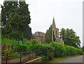
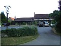
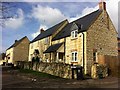
Photos of Little Addington


Area Information
Little Addington represents a distinct village community within the civil parish structure of England. This settlement covers an area of 4.6 square kilometres, offering a contained environment for residents seeking a rural or semi-rural lifestyle. The location defines itself by its compactness, meaning daily journeys often stay local unless specific external amenities are required. Living in Little Addington involves engaging with a setting where the built environment meets natural surroundings, though the specific character of the streets and local green spaces depends on the village layout itself. Prospective buyers considering homes here must understand that this is a settled parish with established boundaries. The area does not feature protected woodland, Areas of Outstanding Natural Beauty, or protected nature reserves within its 4.6 square kilometres. Consequently, residents enjoy open freedom for development or modification without the strict planning constraints found in more sensitive landscapes. However, there is a warning to consider regarding Ramsar wetland sites present in the locality. These designated wetlands impose specific planning restrictions that developers and owners must respect. Those looking for homes in Little Addington will find a defined community footprint. The village operates as a self-contained unit, independent of the surrounding wider rentals or urban sprawl. While the area size provides sufficient space for a hamlet feel, it lacks the infrastructure of a larger town. For you, the buyer, this means evaluating lifestyle needs carefully. You will rely on local services and must plan for travel to larger hubs for major shopping or comprehensive healthcare. The village stands as a quiet, manageable residential option where the planning landscape includes both safety and specific conservation warnings.
- Area Type
- Parish
- Area Size
- 4.6 km²
- Population
- Not available
- Population Density
- Not available
Demographics
The community profile of Little Addington reflects the swing to retirement age. Current data shows a median age of 70 years for the population. This equates to a resident base where two out of every three people are not yet sixty years old, assuming a standard distribution around the median, but more accurately indicates a significant proportion of older residents enjoying independent living. Home ownership stands at 74 per cent of all households in Little Addington. This figure suggests a neighbourhood settled by those who have accumulated wealth or inherited property rather than recent renters or transient workers. The high ownership rate typically correlates with stability and long-term community membership. You will find that most residents treat the village as a permanent home rather than a temporary base. While specific breakdowns of household composition and predominant ethnic group details are not provided in the current dataset, the overall picture paints a clear demographic silhouette. The age profile drives the local culture. Services and social groups likely cater to older adults. Children are less common in the immediate vicinity compared to younger villages. This means your neighbours will probably be peers in their later life stages. The community echo is one of stability and slower pace. Residents also benefit from a landscape free from protected nature reserves within the parish bounds. However, the area does contain Ramsar wetland sites. These are internationally important wetlands. Their presence affects local planning. Any extension or new build near these sites faces strict scrutiny. For you, the buyer, this guarantees that the village gardeners and local nature are protected by national designations, even if no nature reserve plaque marks every path.
Household Size
Accommodation Type
Tenure
Ethnic Group
Religion
Household Composition
Age
Household Deprivation
NS-SEC
Explore more demographic insights in this area
Go to Demographics tabPlanning
Planning Constraints
- Flood RiskPremium
- Ramsar Wetland SitesPremium
- Area of Outstanding Natural BeautyPremium
- Protected Nature ReservePremium
- Protected WoodlandPremium
- Crime RiskPremium