Area Overview for Lenton Keisby and Osgodby
Photos of Lenton Keisby and Osgodby
Area Information
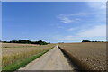
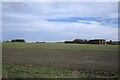
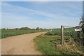
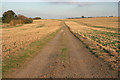
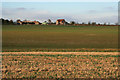
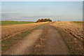
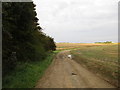
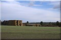
Living in Lenton Keisby and Osgodby means residing within a defined civil parish in England that spans 17.3 square kilometres. This area presents a quiet residential option for those seeking space away from the immediate urban sprawl of Leicester. You will find a landscape shaped significantly by agricultural land and scattered settlements rather than dense urbanisation. The geography supports a low density lifestyle where daily routines often involve driving to nearby services rather than walking to a central high street. Your time here is defined by the presence of Osgodby Hall and the historical significance of the Keisby area. The parish holds the distinction of being the smallest in Lenton Keisby and Osgodby's local government structure yet it encompasses a distinct rural feel. Residents enjoy the benefits of open countryside without being completely isolated from county amenities. You should consider how the terrain influences your daily life. The area contains restricted zones such as protected woodland which adds to the natural environment but may affect specific planning applications. Understanding the scale of the parish helps you gauge the level of services available within walking distance versus what requires a car. The 17.3 km² footprint indicates a spread out community where neighbours may live several hundred metres apart. This location suits buyers who value peace and prefer a slower pace over immediate access to city centre life. The civil parish status implies a level of local governance focused on managing these specific rural boundaries. You are purchasing into a setting where the history of Lenton Keisby and Osgodby remains visible through its land use and settlement patterns.
- Area Type
- Parish
- Area Size
- 17.3 km²
- Population
- Not available
- Population Density
- Not available
Demographics
The community profile of Lenton Keisby and Osgodby stands out immediately due to the median age of 70 years. This figure confirms that the population is heavily skewed towards seniors and retirees. You are looking at an area where the majority of residents are likely retired or approaching retirement age. This demographic reality shapes the local culture and demand for local amenities such as age-appropriate housing and community groups. Home ownership is exceptionally high at 78% within Lenton Keisby and Osgodby. This rate is significantly above the national average and indicates that most households have purchased their current residences. You will rarely find this parish dominated by the private rental sector. The high ownership rate suggests residents have made long-term commitments to this location. The age range data shows that the total population falls into the senior bracket far more than any younger group. This uniformity means you do not need to consider family neighbourhoods with schools or playgrounds as primary factors. Instead, the focus shifts to social clubs, medical facilities, and low-maintenance living environments. The provided data does not detail specific household composition breakdowns beyond the total statistics, so you cannot identify exact numbers of single-person versus multi-generational homes. However, the dominance of the over-seven-decade-old demographic strongly implies fewer young children living in the parish. The homeowner statistic provides a clear indicator of stability and reduced tenant turnover for potential neighbours.
Household Size
Accommodation Type
Tenure
Ethnic Group
Religion
Household Composition
Age
Household Deprivation
NS-SEC
Explore more demographic insights in this area
Go to Demographics tabPlanning
Planning Constraints
- Flood RiskPremium
- Ramsar Wetland SitesPremium
- Area of Outstanding Natural BeautyPremium
- Protected Nature ReservePremium
- Protected WoodlandPremium
- Crime RiskPremium