Area Overview for Long Whatton and Diseworth
Photos of Long Whatton and Diseworth


Area Information
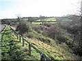
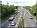
Living in Long Whatton and Diseworth offers a distinctly rural experience centred around a civil parish covering 19.4 km². This location sits near the market town of Louth, positioning residents within the Lincolnshire countryside. The area attracts buyers seeking a slower pace of life away from the urban centres of the East Midlands. Daily life revolves around cycling, walking, and enjoying the open landscape that defines this parcel of land. You will find a quiet environment where the primary focus is on nature and local village communities rather than commercial hustle. The physical scale of the parish is modest, meaning distances to local amenities are short for those with a car. Prospective homebuyers should expect a setting defined by its separation from major conurbations. The proximity to Lincoln and Scunthorpe provides access to larger employment hubs without sacrificing the countryside view from your garden. Long Whatton and Diseworth functions as a satellite community, reliant on nearby towns for significant retail or leisure activities. Your routine will likely involve travel to Louth for weekly shopping, with the parish serving as your residential heart. The area represents a practical choice for commuters who value openness over proximity to a bustling town centre. You trade urban density for the space and air that characterise this specific section of Lincolnshire.
- Area Type
- Parish
- Area Size
- 19.4 km²
- Population
- Not available
- Population Density
- Not available
Demographics
The community within Long Whatton and Diseworth reflects a settled population with a median age of 70 years. This figure indicates an area dominated by older residents, likely living in the homes they have occupied for many decades. The demographic profile suggests a lack of young families or transient workers seeking temporary accommodation. Instead, you are looking at a population that has chosen to spend its final decades in this rural setting. With 79% of households owning their homes outright, financial stability appears high among residents who have built equity over a long period. The social fabric here is defined by this strong home ownership rate, which stands at 79% of the total household composition. This statistic points to a neighbourhood where people stay put rather than renting through the cycle of modern housing markets. Accommodation types mirror this stability, though specific breakdowns by building style are not detailed in the available records. The age profile and ownership levels combine to create a quiet, predictable community dynamic. You will find fewer disturbances associated with nightlife or high turnover of tenants in this parish. Ethnic diversity and religious affiliation data are not recorded in the current statistics for this area, though the low population density often correlates with traditional community structures. Deprivation metrics are absent from the dataset, but the high home ownership rate and older age profile typically suggest a community outside the most deprived zones of the North East. For those living in Long Whatton and Diseworth, daily life is shaped by established routines and stable neighbours who have long roots in the town.
Household Size
Accommodation Type
Tenure
Ethnic Group
Religion
Household Composition
Age
Household Deprivation
NS-SEC
Explore more demographic insights in this area
Go to Demographics tabPlanning
Planning Constraints
- Flood RiskPremium
- Ramsar Wetland SitesPremium
- Area of Outstanding Natural BeautyPremium
- Protected Nature ReservePremium
- Protected WoodlandPremium