Area Overview for Ellistown and Battleflat
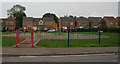
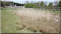
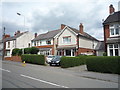
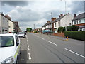
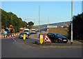
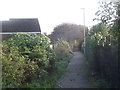
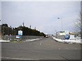
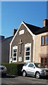
Photos of Ellistown and Battleflat
Area Information
Living in Ellistown and Battleflat offers a distinctly quiet pace set within a compact civil parish spanning 4.6 km². The area functions as a small village community where daily life revolves around close-knit neighbours rather than the noise of nearby urban centres. You will find the parish is situated in a rural pocket of England, defined more by its agricultural heritage and natural surroundings than by commercial development. The landscape is open and spacious, providing residents with immediate access to green spaces without the need for long drives. For those seeking homes in this parish, the environment delivers a serene lifestyle where the busiest time of day is likely the weekend morning. The identity of the area is rooted in tradition, meaning modern conveniences do not dominate the visual or social fabric. Youcentre your home here if you value tranquillity and wish to escape the rapid rhythm of city living. Daily errands require a car, as the parish lacks large retail parks or major transport hubs within its boundaries. Instead, life unfolds through local village halls, small community gardens, and the quiet roads that wind through the parish land. The sense of belonging is strong because contact between residents happens naturally on the street or at local events. This setting remains an ideal choice for anyone who prefers a grounded existence over a fast-paced existence.
- Area Type
- Parish
- Area Size
- 4.6 km²
- Population
- Not available
- Population Density
- Not available
Demographics
The community in Ellistown and Battleflat is characterised by a significantly older population. You will find that 70 per cent of residents fall into the category of older adults, which creates a demographic profile very different from the national average. This age concentration means the local shops and services cater primarily to the needs of mature people and retirees. The crowd is not filtered by diverse household types; instead, the population bulk consists of individuals living alone or couples without children. Consequently, the village atmosphere feels stable and settled rather than transient or rapidly shifting. Home ownership in Ellistown and Battleflat stands at 75 per cent, confirming that the vast majority of people who live here own their property outright or have a mortgage. This high rate of ownership suggests a long-term commitment to the parish and a community where families build roots rather than viewing the location as a short-term staging post. The low turnover typical of owner-occupied estates results in deep familiarity among neighbours. While the predominant ethnic group and religious breakdown are recorded in parish data, the visible face of the population is overwhelmingly defined by age. The social rhythm of the parish reflects this, with community activities often tailored towards the interests and availability of the older generation.
Household Size
Accommodation Type
Tenure
Ethnic Group
Religion
Household Composition
Age
Household Deprivation
NS-SEC
Explore more demographic insights in this area
Go to Demographics tabPlanning
Planning Constraints
- Flood RiskPremium
- Ramsar Wetland SitesPremium
- Area of Outstanding Natural BeautyPremium
- Protected Nature ReservePremium
- Protected WoodlandPremium
- Crime RiskPremium