Area Overview for Ashby Woulds
Photos of Ashby Woulds


Area Information
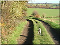
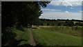
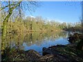
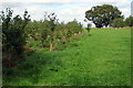
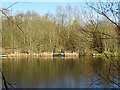
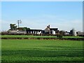
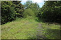
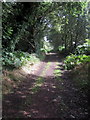
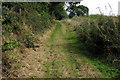
Ashby Woulds is a civil parish located in North West Leicestershire, within the East Midlands region of England. It lies to the west of Ashby de la Zouch and includes main settlements such as Moira and Norris Hill. The area covers a total size of 10.0 km². While the 2011 census recorded a population of 3,763 for the parish including Albert Village, more recent estimates suggest the resident count has declined to approximately 2,143. Living in Ashby Woulds means settling into a locality that balances residential life with access to nearby commercial centres. The parish includes a luxury lodge development situated near the Derbyshire village of Overseal, providing a residential park within The National Forest. This specific development is gated and offers a secluded environment in a countryside setting. Despite the presence of this modern enclave, the broader parish retains its character as a traditional civil parish with a town council. Prospective buyers considering homes in Ashby Woulds must understand that the area operates as a distinct administrative unit with its own governance, alongside the larger towns that surround it. The mix of established villages and new forest lodges creates a varied landscape for those moving to this part of Leicestershire.
- Area Type
- Parish
- Area Size
- 10.0 km²
- Population
- Not available
- Population Density
- Not available
Demographics
The community profile of Ashby Woulds reflects a settled and aged population. Data indicates a median age of 70 years, which suggests an older demographic compared to the national average. The most common age grouping recorded is simply listed as 'Age: Total', indicating the data aggregates all age brackets without specific sub-range breakdowns available in this dataset. Home ownership is a dominant feature of the local housing market, with 72% of residents owning their homes outright. This high rate of ownership contrasts with rental markets found in larger urban centres. Household composition and accommodation type statistics are available only in their broadest categories, marked as 'total', rather than specifying single-person households or family units. The provided data does not separate information by predominant ethnic group or religious affiliation, leaving those specific aspects of community diversity unquantified in the current figures. For residents living in Ashby Woulds, the environment appears to support long-term settlement rather than transient living. This high ownership rate often correlates with stability and lower vacancy rates, meaning you are likely to find neighbours who have resided in the area for a significant period. The lack of detailed breakdowns on ethnic or religious demographics means the specific cultural diversity of the parish remains undefined by the available statistics, though the aging population statistic remains a clear fact about the community makeup.
Household Size
Accommodation Type
Tenure
Ethnic Group
Religion
Household Composition
Age
Household Deprivation
NS-SEC
Explore more demographic insights in this area
Go to Demographics tabPlanning
Planning Constraints
- Flood RiskPremium
- Ramsar Wetland SitesPremium
- Area of Outstanding Natural BeautyPremium
- Protected Nature ReservePremium
- Protected WoodlandPremium