Area Overview for Bottesford
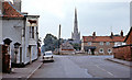
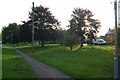
Photos of Bottesford


Area Information
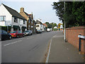
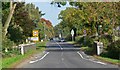
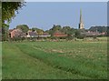
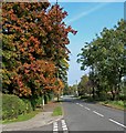
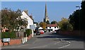
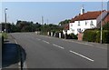
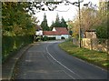
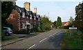
Living in Bottesford means settling into a compact built-up area that covers just 1.4 square kilometres of land in England. This small footprint defines a distinct neighbourhood character where residents often know one another. The location offers a quiet residential experience without the density of a major city centre. You will find a community focused on established homes and steady living rather than rapid development. The area sits within the broader Midlands region, providing a calm base for those seeking a slower pace of life. Daily life here revolves around local convenience and proximity to transport links. Three railway stations serve the vicinity, specifically Bottesford Railway Station, Elton & Orston Railway Station, and Aslockton Railway Station. These connections allow you to travel further afield while maintaining a tranquil home base. The presence of these stations makes Bottesford accessible for commuters without sacrificing the benefits of a smaller settlement. Homes in Bottesford reflect this history, often set back from busy roads. The town supports essential retail needs within easy reach. You can visit the Co-op Bottesford or the Lincolnshire Co-operative Co for groceries and everyday items. This local provision reduces the need for long journeys solely for shopping. The combination of reliable rail options and immediate retail access creates a self-sufficient environment. Families can manage their weekly rounds efficiently while enjoying the lower noise levels typical of such a small area. Bottesford remains a practical choice for those prioritising stability and community connection over urban excitement.
- Area Type
- Built Up Area 250
- Area Size
- 1.4 km²
- Population
- Not available
- Population Density
- Not available
Lifestyle in Bottesford centres on the immediate availability of local services within the 1.4 square kilometre built-up area. For daily shopping needs, you have access to four retail options in the vicinity. Specific names include Co-op Bottesford and variations of the Lincolnshire Co-operative Co. These venues allow you to settle your weekly food and household bills without travelling to Melton Mowbray or Lincoln. The concentration of four shops ensures that running errands does not consume your entire morning. Beyond retail, transport forms a key part of your week. You are positioned close to three railway stations: Bottesford Railway Station, Elton & Orston Railway Station, and Aslockton Railway Station. Proximity to these terminals means you can start your day locally and reach London or Manchester later. This access supports a lifestyle where long-distance work or leisure trips do not require a change of residence. The character of Bottesford is defined by this blend of self-sufficiency and connection. You enjoy the quiet of a village with the reach of a town. Shops like the Co-op provide social hubs where neighbours gather, fostering a community feel. Your daily routine benefits from walkable access to essentials and a short journey to the station. This balance allows you to maintain a relaxed pace while still engaging with the wider region. Living in Bottesford means prioritising convenience and stability in your daily choices.
Amenities
Schools
Families considering schools near Bottesford will find two primary options listed directly for the community. You will encounter Bottesford Church of England Primary School, which operates as a primary institution. This school carries a Good Ofsted rating, signaling consistent educational standards and satisfactory teaching methods. A second option, Belvoir High School and Melton Vale Post 16 Centre, is also classified under primary in the provided records, though its name suggests post-compulsory education functions. Alternatively, The Priory Belvoir Academy serves as an academy within the broader local education network. This institution also holds a Good Ofsted rating, further reinforcing the quality of secondary education accessible to residents. The presence of schools with Good ratings indicates a commitment to educational excellence in the Bottesford catchment area. You do not have to look far for reputable institutions when moving to this location. The mix includes both Church of England and academy types, offering different curricular environments for families. Bottesford Church of England Primary School represents one tradition, while The Priory Belvoir Academy offers an academy model. Both maintain a Good standard, ensuring that attainment levels remain robust. This variety allows parents to choose settings that align with their specific preferences for teaching styles and governance. Schools near Bottesford provide a secure foundation for younger children, supporting the family-oriented aspect of life in this small built-up area.
| Rank | School | Type | Entry gender | Ages |
|---|
Explore more schools in this area
Go to Schools tabDemographics
The community in Bottesford reflects a settled population with a median age of 70. This statistic highlights an area where long-term residents and retirees form the core of society. The highest concentration of residents falls into the Total age bracket, indicating a broad spread rather than a narrow youth-focused demographic. This profile suggests a neighbourhood where life moves at a measured pace and families are less dominant than older households. Home ownership stands at an impressive 80% rate throughout Bottesford. This figure underscores a strong culture of owning one's home rather than renting. With four out of five residents owning their property, the area exudes stability. Such high ownership levels often correlate with longer tenures in the same address. You are unlikely to experience high rates of tenant turnover in this setting. Instead, you will encounter neighbours who have called Bottesford home for many years. The accommodation type data is recorded under a Total category, covering all housing varieties within the built-up area. While specific breakdowns by house style are not detailed, the high ownership percentage implies a stock geared towards permanent living. There is little evidence of a transient rental market here. The demographic landscape points to a homogenous community where residents share similar life stages and economic standing. This consistency creates a predictable environment for those moving to the area for the first time or reinforcing their roots.