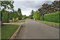
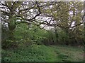
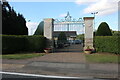
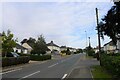
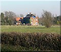
Area Overview for Kirby Muxloe
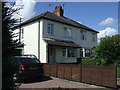
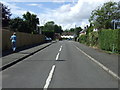
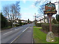
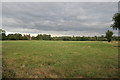
Photos of Kirby Muxloe


Area Information
Living in Kirby Muxloe offers a defined rural experience within a civil parish that spans exactly 7.2 square kilometres. This compact scale means the locality feels intimate, where distances are short and the built environment is close-knit. You will not find the sprawl of a major town; instead, the area functions as a quiet settlement where daily life revolves around local necessities and open space. The region is situated in England, providing access to the wider network of English roads and rural paths without the noise and congestion of city centres. For those seeking a straightforward residential setting, the layout ensures that a significant portion of your week can be spent without venturing far from your front door. The lack of complex planning constraints, such as protected wildlife sites or benches of natural beauty, suggests a straightforward character focused on habitation rather than conservation. While the area is not large, this size allows for a manageable community feel where neighbours are likely to know one another. Kirby Muxloe represents a practical choice for privacy and space, offering a layout where residents currently enjoy high levels of independence and ownership across the parish. The population density aligns with the land area to create a low-pressure living environment suitable for those who prefer a settled, quiet routine over urban bustle.
- Area Type
- Parish
- Area Size
- 7.2 km²
- Population
- Not available
- Population Density
- Not available
Demographics
The community in Kirby Muxloe is defined by a distinctly mature age profile. You should note that the median age for residents reaches 70, positioning the area as a hub for older age groups. This demographic skew reflects a neighbourhood where many current inhabitants have stayed put for decades or have recently moved in for retirement. In terms of household composition, the majority of residents are part of the total household population, but the specific age breakdown heavily influences daily social dynamics. A defining feature of living here is the exceptionally high rate of home ownership, with strikingly 83 per cent of local people owning their properties outright or with a mortgage. This figure significantly exceeds national averages for many areas and points to a location built on long-term residency rather than transient renting. You will find very few private rental properties, meaning the housing stock is likely filled with older homes that previous generations have cherished. The resident base is homogenous regarding demographics, as specific data on predominant ethnic groups or religious affiliations is not detailed in current records. For family life, the presence of elders suggests a quiet, settled atmosphere where tradition and stability are the norm. When considering Kirby Muxloe, you are looking at a place where the typical resident is furthest away from the pressures faced by younger professional hubs. The age structure ensures that local shops and services cater to the needs of an active, mature population.
Household Size
Accommodation Type
Tenure
Ethnic Group
Religion
Household Composition
Age
Household Deprivation
NS-SEC
Explore more demographic insights in this area
Go to Demographics tabPlanning
Planning Constraints
- Flood RiskPremium
- Ramsar Wetland SitesPremium
- Area of Outstanding Natural BeautyPremium
- Protected Nature ReservePremium
- Protected WoodlandPremium