Area Overview for Braunstone
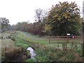
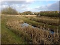
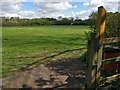
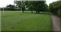
Photos of Braunstone
Area Information
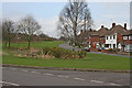
Living in Braunstone offers a defined setting for residents, encompassing 5.0 km² of land with a population of 5,619 people. This creates a tightly knit community where daily interactions are frequent due to the population density of 1,117 people per km². The area functions as a county electoral division where neighbours are typically close friends rather than just adjacent homeowners. You will find that the community knew both before the Great War and continues to value traditional neighbourhood structures. The size of the area means local amenities are accessible without needing to travel far, yet the residential zones remain distinct from industrial or commercial hubs. Families and long-term residents dominate the landscape, creating a stable environment where change happens gradually. The compact nature of the locality ensures that you can explore the entire Braunstone district on foot or by bicycle within minutes. This blend of historical continuity and modern necessity defines the daily rhythm for everyone residing here.
- Area Type
- Parish
- Area Size
- 5.0 km²
- Population
- 5619
- Population Density
- 1117 people/km²
Demographics
The demographic profile of Braunstone reflects a mature community with a median age of 70 years. This stat indicates that the area serves primarily as a retirement location or a home for families raising children who between ages 9 and 17 wish to settle down. Seventy-three percent of households own their homes, which signals a high level of local attachment and stability. The low rental proportion suggests that young professionals or transient workers rarely dominate the housing stock. Because older generations hold the majority of properties, local services cater heavily to the elderly and established families. You will notice fewer families with very young infants compared to areas with median ages under 35. The demographic data confirms that Brittans and local institutions have catered to retirees for decades. Understanding this age profile helps you anticipate the noise levels, political priorities, and social events that shape Braunstone. The strong home ownership rate reinforces a sense of permanence among the current population.
Household Size
Accommodation Type
Tenure
Ethnic Group
Religion
Household Composition
Age
Household Deprivation
NS-SEC
Explore more demographic insights in this area
Go to Demographics tabPlanning
Planning Constraints
- Flood RiskPremium
- Ramsar Wetland SitesPremium
- Area of Outstanding Natural BeautyPremium
- Protected Nature ReservePremium
- Protected WoodlandPremium