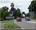
Area Overview for Blaby and Whetstone
Photos of Blaby and Whetstone


Area Information
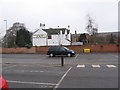
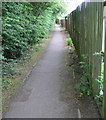
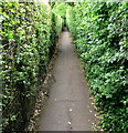
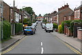
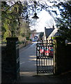
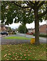
Living in Blaby and Whetstone means residing within a built-up area of 3.9 km². This compact town functions as part of the wider Leicester urban sphere. You will find a neighbourhood defined by stability and established residential character. The area serves as a practical base for those working in nearby hubs while enjoying a grounded community feel. Daily life here combines suburban convenience with proximity to major employment centres. Residents appreciate the small footprint of the settlement which often fosters familiar local interactions. The town lacks the sprawl of larger cities yet offers all the necessary services for modern living. You can walk to essential shops or catch a train for broader exploration. The environment supports a quiet pace where daily routines remain predictable. Homes in this district cater to families seeking a settled lifestyle without city chaos. The layout encourages a blend of local commerce and private residence. Neighbours know each other through regular community contact. This dynamic operates on trust and familiarity rather than transient urban energy. The area provides a solid foundation for long-term settlement. You benefit from a location that balances proximity to larger cities with a distinct small-town identity. The geography supports easy access to both rural edges and metropolitan infrastructure. Life here is practical, organised, and free from the constant flux of bigger towns.
- Area Type
- Built Up Area 250
- Area Size
- 3.9 km²
- Population
- Not available
- Population Density
- Not available
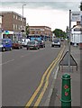
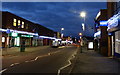
Living in Blaby and Whetstone offers convenient access to practical retail and leisure amenities. Five major retailers operate within easy reach. Co-op Whetstone, Asda Leicester, and Iceland Blaby provide essential grocery needs. You do not need a car for routine shopping trips. These venues handle everything from daily groceries to household supplies. The retail landscape supports a self-sufficient lifestyle where you do not have to travel far for basics. Dining options likely complement these stores with local pubs or cafes serving the community. Parks and green spaces surround the 3.9 km² area providing room for exercise and relaxation. The neighbourhood design prioritises walkability.
Amenities
Schools
Schools near Blaby and Whetstone offer primary education for children in the vicinity. Blaby Thistly Meadow Primary School holds a good Ofsted rating. This institution provides quality basic education. Badgerbrook Primary School also serves the local catchment area alongside Blaby Stokes Church of England Primary School. St Peter's Church of England Primary School Whetstone completes the list of significant primaries. Blaby Community Home operates as an other type facility, likely catering to specific regional needs rather than standard state schooling. This selection of schools indicates that the immediate neighbourhood primarily serves young families needing primary education. However, the high median age of the community suggests many children attend schools outside this immediate 3.9 km² boundary. Parents in Blaby and Whetstone often rely on larger secondary schools in neighbouring towns. The proximity of Blaby Thistly Meadow Primary School ensures that some families can access good rated learning close to home. The presence of multiple primary options offers choice for local householders. Each school listed operates within the agreed catchment or departmental framework. You can choose based on your child's needs and the specific Ofsted judgment.
| Rank | School | Type | Entry gender | Ages |
|---|
Explore more schools in this area
Go to Schools tabDemographics
The community in Blaby and Whetstone presents a distinct age profile. The median age stands at 70 years, indicating a population significantly older than the national average. This demographic skew suggests a neighbourhood where retirees and older adults form the core of society. Most households consist of individuals or couples rather than nuclear families with young children. This shift influences local demand and atmospheric character. You will encounter fewer young residents compared to other parts of the region. The household composition reflects a settled lifestyle where long-term stability prevails. Home ownership rates reach an impressive 76 per cent within the area boundaries. This high figure confirms that residents prefer owning their homes over renting. The accommodation type distribution mirrors this preference for stability. You are unlikely to find a bustling student population or transient worker housing. The diversity of the area focuses on shared life experiences among older generations. This demographic reality shapes how public spaces are used and what community services remain in focus. The area feels like a retirement haven or a lifelong retirement destination rather than a family launchpad. Residents value peace, quiet, and established routines.