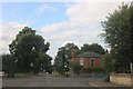
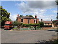
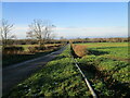
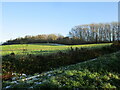
Area Overview for Leadenham
Photos of Leadenham


Area Information
Leadenham is a built-up area in Lincolnshire covering 29 hectares. It functions as a small town rather than a sprawling city, offering a compact environment where residents know their surroundings well. The area is situated close to RAF Cranwell and the Ancaster Railway Station, which suggests its historical ties to military training and rail transport remain relevant features of its identity. Living in Leadenham means settling into a community where the pace is generally unhurried compared to larger urban centres. You can access five retail outlets immediately to your left or right, supporting daily errands without needing to travel far. The location sits near significant digital infrastructure gaps, as fixed broadband scores register low despite strong mobile coverage. This contrast shapes the local lifestyle, where reliable in-person connections through schools and shops often outweigh digital conveniences. The area remains affordable and accessible, making it an option for those prioritising space and quiet over metropolitan amenities. You will find a tight-knit community where residents rely on established walkable distances rather than heavy reliance on complex transport links. The character of Leadenham is defined by its simplicity and the presence of long-standing institutions like local churches and primary schools that anchor daily life.
- Area Type
- Built Up Area 250
- Area Size
- 29.0 hectares
- Population
- Not available
- Population Density
- Not available
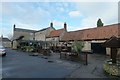
Daily life in Leadenham is centred on a compact cluster of amenities that serve the 75 per cent ownership population. You have five retail outlets immediately accessible, including two Spar stores and a Lincolnshire Co-operative Co. These venues provide essential groceries and daily consumables without requiring a car for short trips. The area also lies close to RAF Cranwell, a major airport which adds a unique element to the local character and potential soundscapes. For those needing rail travel, Ancaster Railway Station is nearby, offering a connection point for broader journeys. There are no leisure parks, cinemas, or large-format entertainment venues listed in the immediate practical reach, meaning social life extends beyond the 29-hectare boundary. The lifestyle is defined by necessity and quiet; you do the basics yourself at the Spar or Co-op rather than shopping in distant malls. Dining options are likely limited to what the supermarkets offer or takeaway services found at these specific retailers. You will find a self-sufficient atmosphere where locals manage their household needs within walking or cycling distance. The presence of the Air Force base suggests a background of order and routine that permeates daily existence. While vibrant nightlife or varied dining cannot be confirmed from this data, the reliable retail provision ensures you remain supplied with essentials. Living in Leadenham means trading variety for convenience in a very bounded area.
Amenities
Schools
Families living in Leadenham have access to two specific educational institutions within the immediate vicinity. Leadenham Church of England Primary School serves the younger generations as a primary education provider. The area also hosts Leadenham Church of England Academy, which manages secondary or older primary education. These are the only schools currently listed as being nearest to the built-up area. The presence of both a primary and an academy suggests a range might exist for children of different ages, although you must verify catchment areas separately as this data lists only names and types. There are no independent or comprehensive schools mentioned in the nearby list, indicating a publicly funded system dominates local education choices. Students attending these schools will likely grow up in the same community as their parents, reinforcing the stable demographic profile described elsewhere. While Ofsted ratings are not provided in the current data, the accreditation as an Academy and a Church of England Primary School confirms their formal status within the national education system. Parents considering living in Leadenham must be aware that this is a small town setting with limited educational options strictly to the left or right. The co-educational nature of these institutions, implied by their names, means there is no gender-segregated schooling in this list.
| Rank | School | Type | Entry gender | Ages |
|---|
Explore more schools in this area
Go to Schools tabDemographics
The community in Leadenham presents a distinct profile for any homebuyer looking to understand who lives here. Data shows a median age of 70, placing the most common age range squarely within the senior demographics. This statistic suggests a neighbourhood where retirement and later-life living dominate the street scene. Home ownership stands at 75 per cent, indicating a market driven by long-term residents who have built equity in their properties over decades rather than young renters or investors. You do not need to navigate a competitive rental market here, as the area is overwhelmingly composed of owners. There is no specific data available regarding household composition breakdowns, ethnicity, or religious affiliation, meaning the visible demographic is solely defined by age and tenure. The absence of younger family demographics or diverse ethnic groups in the available records points to a traditional, established settlement. If you are considering homes in Leadenham, you are entering an area where the social fabric is woven around stability and longevity. The 70-year-old median age means services and neighbourly interactions cater to an older population, creating a predictable and quiet environment. You should expect a residents' base that values tenure and local continuity above transient mobility.
Household Size
Accommodation Type
Tenure
Ethnic Group
Religion
Household Composition
Age
Household Deprivation
NS-SEC
Explore more demographic insights in this area
Go to Demographics tabPlanning
Planning Constraints
- Crime RiskPremium