Area Overview for Lea Ward
Photos of Lea Ward
Area Information
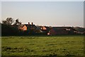
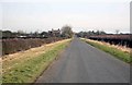
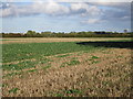
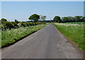
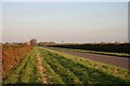
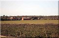
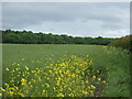
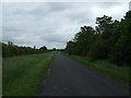
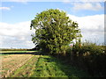
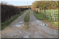
Living in Lea Ward means settling into a district with pronounced historical character and a distinct rhythm of daily life. The ward covers an area of 28.5 km², situated within the Borough of Waverley in England. It is not a sprawling new development but rather an established locality where the pace of life often slows as you move further from the main thoroughfares. Prospective homebuyers find a setting defined by its age profile and sense of history, rather than modern urban density. The sheer size of the ward provides a buffer against the busier parts of the surrounding borough, creating a more secluded atmosphere for most residents. You will notice that daily life here focuses on sustainability and quiet neighbourhood living. The physical layout supports a community-focused ethos rather than high-speed commuting or transient housing markets. The area feels grounded, with landscapes shaped by nature and long-term settlement patterns. When you look at maps of Lea Ward, you see a district where the boundaries feel natural and the environment takes precedence over commercial expansion. This 28.5 km² expanse offers enough space for privacy without cutting you off from essential services. It is an environment where you settle in for the long term, surrounded by the quiet dignity of an older English ward.
- Area Type
- District Borough Unitary Ward
- Area Size
- 28.5 km²
- Population
- Not available
- Population Density
- Not available
Demographics
The community within Lea Ward presents a clear demographic picture centred on later life. The median age stands at 70 years, indicating that the resident population is significantly older than the national average. Most households consist of adults in total age brackets typical for retirement or nearing retirement. This age distribution shapes the social fabric of the ward, creating a settlement where intergenerational diversity is limited compared to more dynamic city districts. You will find that 86% of homes are owner-occupied, reflecting a high level of residential stability and long-term attachment to the property. This ownership rate suggests that residents have deep roots in the area and are unlikely to move frequently. The accompanying household composition data confirms that families with young children are a minority within the ward. Instead, the day-to-day life revolves around established routines familiar to an older demographic. The accommodation type reflects this reality, with a stock dominated by properties suitable for single occupants or couples rather than large multi-generational families. You are buying into a quiet, settled community where neighbours have lived for decades.
Household Size
Accommodation Type
Tenure
Ethnic Group
Religion
Household Composition
Age
Household Deprivation
NS-SEC
Explore more demographic insights in this area
Go to Demographics tabPlanning
Planning Constraints
- Flood RiskPremium
- Ramsar Wetland SitesPremium
- Area of Outstanding Natural BeautyPremium
- Protected Nature ReservePremium
- Protected WoodlandPremium
- Crime RiskPremium