Area Overview for LE9 9JF
Photos of LE9 9JF
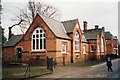
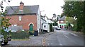
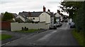
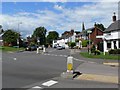
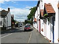
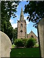
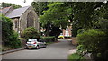
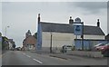
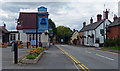
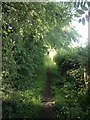
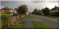
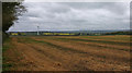
42 photos from this area
Area Information
Key information about the LE9 9JF including its size, population, and administrative classification.
- Area Type
- Postcode
- Area Size
- 2.3 hectares
- Population
- 1973
- Population Density
- 182 people/km²
House Prices in LE9 9JF
42
Properties
£235,600
Average Sold Price
£57,250
Lowest Price
£556,000
Highest Price
Showing 42 properties
| Address | Type | Beds | Baths | Last Sale Price | Last Sale Date | |
|---|---|---|---|---|---|---|
| 72 High Street, Desford, LE9 9JF | Terraced | 3 | - | £170,000 | Sep 2025 | |
| 56 High Street, Desford, LE9 9JF | Detached | 2 | 1 | £275,000 | May 2025 | |
| 6 High Street, Desford, LE9 9JF | Terraced | 2 | 1 | £220,000 | Dec 2024 | |
| 74 High Street, Desford, LE9 9JF | Terraced | 3 | 3 | £250,000 | Dec 2021 | |
| The Latches, 60 High Street, Desford, LE9 9JF | house | 3 | 1 | £360,000 | Jun 2021 | |
| 10 High Street, Desford, LE9 9JF | Terraced | 2 | - | £206,000 | Nov 2020 | |
| The Old Manor Barn, 32A High Street, Desford, LE9 9JF | Detached | 4 | 3 | £490,000 | Sep 2020 | |
| 8 High Street, Desford, LE9 9JF | house | 2 | 1 | £180,000 | Feb 2020 | |
| 17 High Street, Desford, LE9 9JF | house | 2 | 1 | £150,000 | Dec 2019 | |
| 4 High Street, Desford, LE9 9JF | Terraced | 2 | 1 | £182,500 | Jul 2019 |
Page 1 of 5
Energy Efficiency in LE9 9JF
Amenities
Schools
| Rank | School | Type | Entry gender | Ages |
|---|
Explore more schools in this area
Go to Schools tabDemographics
Household Size
Two person
most common
Accommodation Type
Houses
most common
Tenure
89
majority
Ethnic Group
White
most common
Religion
N/A
most common
Household Composition
N/A
most common
Age
47
median
Adults (30-64 years)
most common
Household Deprivation
N/A
with no deprivation
NS-SEC
47
in Lower managerial occupations
Explore more demographic insights in this area
Go to Demographics tabPlanning
Planning Constraints
- Flood RiskPremium
- Ramsar Wetland SitesPremium
- Area of Outstanding Natural BeautyPremium
- Protected Nature ReservePremium
- Protected WoodlandPremium