Area Overview for LE9 9FF
Photos of LE9 9FF
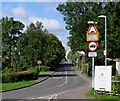
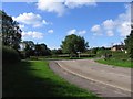
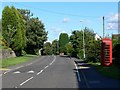
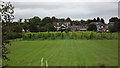
26 photos from this area
Area Information
Key information about the LE9 9FF including its size, population, and administrative classification.
- Area Type
- Postcode
- Area Size
- 59.9 hectares
- Population
- 1973
- Population Density
- 182 people/km²
House Prices in LE9 9FF
68
Properties
£364,856
Average Sold Price
£57,500
Lowest Price
£787,150
Highest Price
Showing 68 properties
| Address | Type | Beds | Baths | Last Sale Price | Last Sale Date | |
|---|---|---|---|---|---|---|
| Holbrook, Main Street, Botcheston, LE9 9FF | Detached | 4 | 2 | £567,250 | Oct 2025 | |
| Highlands, Main Street, Botcheston, LE9 9FF | Detached | 4 | 2 | £630,000 | Aug 2025 | |
| Highfield House, Main Street, Botcheston, LE9 9FF | Detached | 4 | 2 | £495,000 | Mar 2025 | |
| The Hawthorns, Main Street, Botcheston, LE9 9FF | Detached | 4 | 3 | £477,500 | Feb 2025 | |
| 14 Main Street, Botcheston, LE9 9FF | house | - | - | £657,500 | Mar 2024 | |
| Wind Rush, Main Street, Botcheston, LE9 9FF | Detached | 3 | 1 | £405,000 | Dec 2023 | |
| Brooklyn, Main Street, Botcheston, LE9 9FF | Bungalow | 4 | 2 | £685,000 | Nov 2023 | |
| Beggars Roost, Main Street, Botcheston, LE9 9FF | house | - | - | £560,000 | Aug 2022 | |
| One Oak, Main Street, Botcheston, LE9 9FF | Detached | 6 | 3 | £480,000 | Jun 2021 | |
| 12 Main Street, Botcheston, LE9 9FF | house | - | - | £600,000 | Feb 2021 |
Page 1 of 7
Energy Efficiency in LE9 9FF
Amenities
Schools
| Rank | School | Type | Entry gender | Ages |
|---|
Explore more schools in this area
Go to Schools tabDemographics
Household Size
Two person
most common
Accommodation Type
Houses
most common
Tenure
89
majority
Ethnic Group
White
most common
Religion
N/A
most common
Household Composition
N/A
most common
Age
47
median
Adults (30-64 years)
most common
Household Deprivation
N/A
with no deprivation
NS-SEC
47
in Lower managerial occupations
Explore more demographic insights in this area
Go to Demographics tabPlanning
Planning Constraints
- Flood RiskPremium
- Ramsar Wetland SitesPremium
- Area of Outstanding Natural BeautyPremium
- Protected Nature ReservePremium
- Protected WoodlandPremium