Area Overview for LE9 8HS
Photos of LE9 8HS
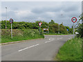
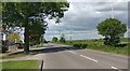
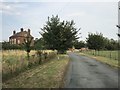
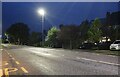
16 photos from this area
Area Information
Key information about the LE9 8HS including its size, population, and administrative classification.
- Area Type
- Postcode
- Area Size
- 9853 m²
- Population
- 1415
- Population Density
- 361 people/km²
House Prices in LE9 8HS
25
Properties
£139,998
Average Sold Price
£46,000
Lowest Price
£225,000
Highest Price
Showing 25 properties
| Address | Type | Beds | Baths | Last Sale Price | Last Sale Date | |
|---|---|---|---|---|---|---|
| 106 Hereford Close, Barwell, LE9 8HS | Detached | 4 | 1 | £223,516 | Mar 2024 | |
| 94 Hereford Close, Barwell, LE9 8HS | Semi-detached | 2 | 1 | £191,000 | Jun 2021 | |
| 90 Hereford Close, Barwell, LE9 8HS | Semi-detached | 2 | 1 | £168,500 | Aug 2020 | |
| 84 Hereford Close, Barwell, LE9 8HS | Semi-detached | 3 | 1 | £185,000 | Feb 2020 | |
| 104 Hereford Close, Barwell, LE9 8HS | Detached | 4 | 2 | £225,000 | Nov 2019 | |
| 96 Hereford Close, Barwell, LE9 8HS | Semi-detached | 2 | 1 | £163,000 | Mar 2019 | |
| 92 Hereford Close, Barwell, LE9 8HS | Semi-detached | 2 | 1 | £125,000 | Nov 2018 | |
| 71 Hereford Close, Barwell, LE9 8HS | Detached | 3 | 1 | £183,000 | Feb 2017 | |
| 88 Hereford Close, Barwell, LE9 8HS | Detached | 3 | 2 | £195,000 | Nov 2016 | |
| 73 Hereford Close, Barwell, LE9 8HS | Detached | 3 | - | £172,000 | Jun 2016 |
Page 1 of 3
Energy Efficiency in LE9 8HS
Amenities
Schools
| Rank | School | Type | Entry gender | Ages |
|---|
Explore more schools in this area
Go to Schools tabDemographics
Household Size
Two person
most common
Accommodation Type
Houses
most common
Tenure
82
majority
Ethnic Group
White
most common
Religion
N/A
most common
Household Composition
N/A
most common
Age
47
median
Adults (30-64 years)
most common
Household Deprivation
N/A
with no deprivation
NS-SEC
27
in Lower managerial occupations
Explore more demographic insights in this area
Go to Demographics tabPlanning
Planning Constraints
- Flood RiskPremium
- Ramsar Wetland SitesPremium
- Area of Outstanding Natural BeautyPremium
- Protected Nature ReservePremium
- Protected WoodlandPremium