Area Overview for LE9 8FB
Photos of LE9 8FB
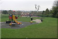
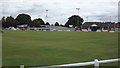
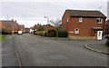
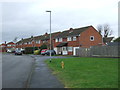
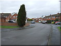
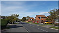
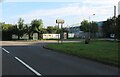
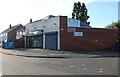
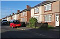
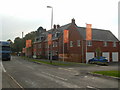
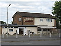
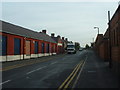
15 photos from this area
Area Information
Key information about the LE9 8FB including its size, population, and administrative classification.
- Area Type
- Postcode
- Area Size
- 1.4 hectares
- Population
- Not available
- Population Density
- Not available
House Prices in LE9 8FB
49
Properties
£114,103
Average Sold Price
£36,500
Lowest Price
£189,500
Highest Price
Showing 49 properties
| Address | Type | Beds | Baths | Last Sale Price | Last Sale Date | |
|---|---|---|---|---|---|---|
| 33 Bradgate Road, Barwell, LE9 8FB | Terraced | 3 | 1 | £189,500 | Feb 2025 | |
| 59 Bradgate Road, Barwell, LE9 8FB | Semi-detached | 3 | 1 | £180,000 | Nov 2022 | |
| 73 Bradgate Road, Barwell, LE9 8FB | house | - | - | £120,000 | Nov 2021 | |
| 65 Bradgate Road, Barwell, LE9 8FB | Detached | 3 | 1 | £143,500 | May 2021 | |
| 5 Bradgate Road, Barwell, LE9 8FB | house | - | - | £146,500 | Jan 2021 | |
| 97 Bradgate Road, Barwell, LE9 8FB | Semi-detached | 3 | - | £145,000 | Apr 2019 | |
| 99 Bradgate Road, Barwell, LE9 8FB | Semi-detached | 3 | 1 | £121,550 | Mar 2019 | |
| 45 Bradgate Road, Barwell, LE9 8FB | Semi-detached | 3 | 1 | £110,000 | Apr 2018 | |
| 89 Bradgate Road, Barwell, LE9 8FB | Semi-detached | 2 | 1 | £136,000 | Feb 2018 | |
| 51 Bradgate Road, Barwell, LE9 8FB | Semi-detached | - | - | £108,000 | Mar 2015 |
Page 1 of 5
Energy Efficiency in LE9 8FB
Amenities
Schools
| Rank | School | Type | Entry gender | Ages |
|---|
Explore more schools in this area
Go to Schools tabDemographics
Household Size
Two person
most common
Accommodation Type
Houses
most common
Tenure
67
majority
Ethnic Group
White
most common
Religion
N/A
most common
Household Composition
N/A
most common
Age
47
median
Adults (30-64 years)
most common
Household Deprivation
N/A
with no deprivation
NS-SEC
25
in Lower managerial occupations
Explore more demographic insights in this area
Go to Demographics tabPlanning
Planning Constraints
- Flood RiskPremium
- Ramsar Wetland SitesPremium
- Area of Outstanding Natural BeautyPremium
- Protected Nature ReservePremium
- Protected WoodlandPremium