Area Overview for LE9 8EE
Photos of LE9 8EE
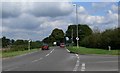
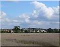
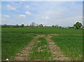
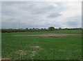
16 photos from this area
Area Information
Key information about the LE9 8EE including its size, population, and administrative classification.
- Area Type
- Postcode
- Area Size
- 1.6 hectares
- Population
- 1415
- Population Density
- 361 people/km²
House Prices in LE9 8EE
26
Properties
£124,419
Average Sold Price
£51,500
Lowest Price
£267,000
Highest Price
Showing 26 properties
| Address | Type | Beds | Baths | Last Sale Price | Last Sale Date | |
|---|---|---|---|---|---|---|
| 7 St Marys Avenue, Barwell, LE9 8EE | Semi-detached | 3 | 3 | £267,000 | Jun 2023 | |
| 5 St Marys Avenue, Barwell, LE9 8EE | house | - | - | £175,000 | Jan 2021 | |
| 11 St Marys Avenue, Barwell, LE9 8EE | Semi-detached | 3 | 1 | £166,000 | Dec 2020 | |
| 51 St Marys Avenue, Barwell, LE9 8EE | Semi-detached | 3 | 1 | £220,000 | Sep 2019 | |
| 49 St Marys Avenue, Barwell, LE9 8EE | Semi-detached | - | - | £120,000 | Dec 2015 | |
| 43 St Marys Avenue, Barwell, LE9 8EE | Semi-detached | 3 | 2 | £122,500 | Oct 2013 | |
| 15 St Marys Avenue, Barwell, LE9 8EE | Maisonette | - | - | £59,950 | Feb 2012 | |
| 27 St Marys Avenue, Barwell, LE9 8EE | Flat | - | - | £70,000 | Aug 2007 | |
| 31 St Marys Avenue, Barwell, LE9 8EE | Flat | 1 | 1 | £85,000 | Jul 2005 | |
| 37 St Marys Avenue, Barwell, LE9 8EE | Semi-detached | - | - | £112,000 | Aug 2004 |
Page 1 of 3
Energy Efficiency in LE9 8EE
Amenities
Schools
| Rank | School | Type | Entry gender | Ages |
|---|
Explore more schools in this area
Go to Schools tabDemographics
Household Size
Two person
most common
Accommodation Type
Houses
most common
Tenure
82
majority
Ethnic Group
White
most common
Religion
N/A
most common
Household Composition
N/A
most common
Age
47
median
Adults (30-64 years)
most common
Household Deprivation
N/A
with no deprivation
NS-SEC
27
in Lower managerial occupations
Explore more demographic insights in this area
Go to Demographics tabPlanning
Planning Constraints
- Flood RiskPremium
- Ramsar Wetland SitesPremium
- Area of Outstanding Natural BeautyPremium
- Protected Nature ReservePremium
- Protected WoodlandPremium