Area Overview for LE9 7EU
Photos of LE9 7EU


Area Information
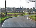
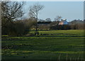
Living in LE9 7EU offers a quiet, compact residential experience in a small cluster of homes. With a population of 1,968 and a density of 794 people per square kilometre, this area balances proximity with a sense of space. The community is characterised by a mature demographic, with a median age of 47 and a majority of residents aged 30–64. This suggests a stable, established neighbourhood where many have lived for years. Daily life is shaped by local amenities, including five retail outlets such as Morrisons Daily and Tesco Barewell, which cater to everyday needs. The area’s small size means residents can easily access nearby services, while the presence of two schools—Saint Peters Catholic Primary and Saint Peters Catholic Voluntary Academy—provides educational options for families. LE9 7EU is not a sprawling suburb but a tightly knit community, ideal for those seeking a low-maintenance lifestyle with essential facilities within reach.
- Area Type
- Postcode
- Area Size
- Not available
- Population
- 1968
- Population Density
- 794 people/km²
The property market in LE9 7EU is dominated by owner-occupied homes, with 60% of properties owned by residents rather than rented. This suggests a stable housing stock where long-term residency is common. The accommodation type is primarily houses, which is typical for smaller, residential clusters. This contrasts with areas dominated by flats or apartments, offering more space and privacy. The small size of the area means the housing stock is limited, which could make property searches more focused on immediate surroundings. For buyers, this implies a niche market where availability is constrained, but the presence of established homes may appeal to those seeking a mature, low-maintenance environment. The lack of rental properties also indicates a community where homeownership is the norm.
House Prices in LE9 7EU
No properties found in this postcode.
Energy Efficiency in LE9 7EU
Life in LE9 7EU is shaped by its compact size and proximity to essential amenities. Five retail outlets, including Morrisons Daily, Co-op Earl, and Tesco Barewell, provide everyday shopping options, reducing the need for long trips. The presence of two railway stations—Hinckley and Shenton—enhances accessibility to nearby towns and services. While the area lacks large parks or leisure facilities, the small cluster of homes suggests a community-focused lifestyle where local interactions are common. Residents can enjoy a mix of practical convenience and a quiet, established environment. The absence of major highways or sprawling developments means the area retains a village-like character, with amenities tailored to daily needs rather than sprawling commercial hubs. This balance of accessibility and tranquillity defines the lifestyle in LE9 7EU.
Amenities
Schools
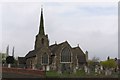
Residents of LE9 7EU have access to two schools within practical reach. Saint Peters Catholic Primary School in Earl Shilton serves younger children, while Saint Peters Catholic Voluntary Academy provides secondary education. Both institutions are Catholic and likely follow a faith-based curriculum, which may appeal to families with specific educational preferences. The presence of a primary and a secondary school within the same network offers continuity for families, reducing the need to commute to distant schools. While no Ofsted ratings are provided, the existence of two schools in close proximity suggests a commitment to education in the area. For parents, this combination of primary and secondary schooling can simplify family logistics and ensure children receive a consistent educational experience.
| Rank | School | Type | Entry gender | Ages |
|---|
Explore more schools in this area
Go to Schools tabDemographics
The demographic profile of LE9 7EU reflects a mature, predominantly White population, with 60% of homes owned by residents rather than rented. The median age of 47 and the concentration of adults aged 30–64 indicate a community of long-term residents, many of whom are likely in their prime working years. This age group typically prioritises stability, which aligns with the area’s low crime risk score of 70 and its absence of environmental constraints like protected woodlands or AONBs. The high home ownership rate suggests a preference for settled living, though the small population size means the area is not densely populated. With no significant deprivation data provided, the quality of life here appears to be shaped by accessibility to local services and a safe, low-risk environment.
Household Size
Accommodation Type
Tenure
Ethnic Group
Religion
Household Composition
Age
Household Deprivation
NS-SEC
Explore more demographic insights in this area
Go to Demographics tabPlanning
Planning Constraints
- Flood RiskPremium
- Ramsar Wetland SitesPremium
- Area of Outstanding Natural BeautyPremium
- Protected Nature ReservePremium
- Protected WoodlandPremium