Area Overview for LE9 7EF
Photos of LE9 7EF
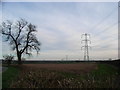
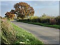
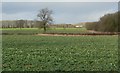
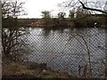
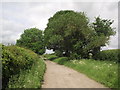
8 photos from this area
Area Information
Key information about the LE9 7EF including its size, population, and administrative classification.
- Area Type
- Postcode
- Area Size
- 76.6 hectares
- Population
- 1968
- Population Density
- 794 people/km²
House Prices in LE9 7EF
38
Properties
£255,024
Average Sold Price
£51,000
Lowest Price
£675,000
Highest Price
Showing 38 properties
| Address | Type | Beds | Baths | Last Sale Price | Last Sale Date | |
|---|---|---|---|---|---|---|
| North View, 5 Thurlaston Lane, Earl Shilton, LE9 7EF | Semi-detached | 3 | 1 | £250,000 | Dec 2023 | |
| Sorrento, 1 Thurlaston Lane, Earl Shilton, LE9 7EF | Semi-detached | 2 | 1 | £250,000 | Sep 2023 | |
| Sidneydene, 29 Thurlaston Lane, Earl Shilton, LE9 7EF | Semi-detached | 3 | 1 | £155,000 | Feb 2023 | |
| Elms Farm, Thurlaston Lane, Earl Shilton, LE9 7EF | house | - | - | £675,000 | Oct 2022 | |
| Maycroft, 25 Thurlaston Lane, Earl Shilton, LE9 7EF | Semi-detached | 4 | - | £316,000 | Jan 2022 | |
| 48 Thurlaston Lane, Earl Shilton, LE9 7EF | Detached | 4 | 2 | £330,000 | Jun 2021 | |
| Fair Lawn, 39 Thurlaston Lane, Earl Shilton, LE9 7EF | Semi-detached | 2 | - | £334,000 | Feb 2021 | |
| Valley View, 41 Thurlaston Lane, Earl Shilton, LE9 7EF | Detached | 3 | - | £300,000 | Dec 2020 | |
| Grafton, 3 Thurlaston Lane, Earl Shilton, LE9 7EF | Semi-detached | 2 | 1 | £210,000 | Sep 2020 | |
| Seymour, 21 Thurlaston Lane, Earl Shilton, LE9 7EF | Detached | 3 | 1 | £240,000 | Aug 2020 |
Page 1 of 4
Energy Efficiency in LE9 7EF
Amenities
Schools
| Rank | School | Type | Entry gender | Ages |
|---|
Explore more schools in this area
Go to Schools tabDemographics
Household Size
Two person
most common
Accommodation Type
Houses
most common
Tenure
60
majority
Ethnic Group
White
most common
Religion
N/A
most common
Household Composition
N/A
most common
Age
47
median
Adults (30-64 years)
most common
Household Deprivation
N/A
with no deprivation
NS-SEC
26
in Lower managerial occupations
Explore more demographic insights in this area
Go to Demographics tabPlanning
Planning Constraints
- Flood RiskPremium
- Ramsar Wetland SitesPremium
- Area of Outstanding Natural BeautyPremium
- Protected Nature ReservePremium
- Protected WoodlandPremium