Area Overview for LE9 7AH
Photos of LE9 7AH

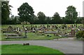
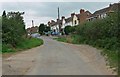
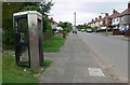
13 photos from this area
Area Information
Key information about the LE9 7AH including its size, population, and administrative classification.
- Area Type
- Postcode
- Area Size
- 1.4 hectares
- Population
- 1628
- Population Density
- 2685 people/km²
House Prices in LE9 7AH
26
Properties
£156,564
Average Sold Price
£78,000
Lowest Price
£249,000
Highest Price
Showing 26 properties
| Address | Type | Beds | Baths | Last Sale Price | Last Sale Date | |
|---|---|---|---|---|---|---|
| 53 Alexander Avenue, Earl Shilton, LE9 7AH | Flat | 2 | 1 | £133,000 | Sep 2025 | |
| 77 Alexander Avenue, Earl Shilton, LE9 7AH | Semi-detached | 3 | 1 | £230,000 | Apr 2024 | |
| 55 Alexander Avenue, Earl Shilton, LE9 7AH | house | - | - | £159,950 | Jan 2019 | |
| 83 Alexander Avenue, Earl Shilton, LE9 7AH | Detached | 4 | 2 | £249,000 | Nov 2018 | |
| The Manse, Alexander Avenue, Earl Shilton, LE9 7AH | house | - | - | £225,000 | Jun 2018 | |
| 41 Alexander Avenue, Earl Shilton, LE9 7AH | Semi-detached | 3 | 1 | £137,000 | Oct 2016 | |
| 65 Alexander Avenue, Earl Shilton, LE9 7AH | house | - | - | £110,000 | Jan 2016 | |
| 75 Alexander Avenue, Earl Shilton, LE9 7AH | Semi-detached | 3 | 1 | £111,000 | Oct 2013 | |
| 39 Alexander Avenue, Earl Shilton, LE9 7AH | house | - | - | £118,000 | Feb 2013 | |
| 85 Alexander Avenue, Earl Shilton, LE9 7AH | Semi-detached | 3 | 1 | £194,000 | Aug 2007 |
Page 1 of 3
Energy Efficiency in LE9 7AH
Amenities
Schools
| Rank | School | Type | Entry gender | Ages |
|---|
Explore more schools in this area
Go to Schools tabDemographics
Household Size
One person
most common
Accommodation Type
Houses
most common
Tenure
47
majority
Ethnic Group
White
most common
Religion
N/A
most common
Household Composition
N/A
most common
Age
47
median
Adults (30-64 years)
most common
Household Deprivation
N/A
with no deprivation
NS-SEC
21
in Lower managerial occupations
Explore more demographic insights in this area
Go to Demographics tabPlanning
Planning Constraints
- Flood RiskPremium
- Ramsar Wetland SitesPremium
- Area of Outstanding Natural BeautyPremium
- Protected Nature ReservePremium
- Protected WoodlandPremium