Area Overview for LE9 6WG
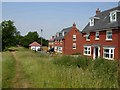
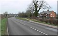
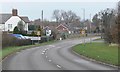
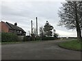
Photos of LE9 6WG


Area Information
Living in LE9 6WG offers a quiet, residential experience in a small cluster of homes, ideal for those seeking a stable, low-maintenance lifestyle. With a population of 2,264, the area is compact yet well-served by nearby amenities. The community is predominantly composed of adults aged 30–64, reflecting a mature demographic with strong home ownership—77% of residents own their properties. This suggests a settled, long-term presence in the area. Daily life is shaped by proximity to local shops, a railway station, and two primary schools, making it practical for families and commuters. The area’s small size means a close-knit feel, with limited but functional infrastructure. While it lacks large-scale developments, its simplicity and accessibility to nearby towns via rail and road make it appealing for those prioritising convenience over urban vibrancy. The low crime risk and absence of environmental constraints further enhance its appeal as a safe, straightforward place to live.
- Area Type
- Postcode
- Area Size
- Not available
- Population
- 2264
- Population Density
- 2949 people/km²
The property market in LE9 6WG is characterised by strong home ownership, with 77% of properties owned by residents rather than rented. This suggests a market skewed towards owner-occupied homes, which may indicate a preference for long-term investment over short-term rental opportunities. The accommodation type is predominantly houses, reflecting a residential area with larger, more private properties compared to flats or apartments. Given the small size of the postcode area, the housing stock is likely limited, making the market competitive for buyers seeking properties in the immediate vicinity. The focus on houses may appeal to families or individuals prioritising space and privacy, though the limited number of properties could mean fewer options for buyers. Those considering the area should note that the market is not rental-focused, which may influence availability and pricing dynamics.
House Prices in LE9 6WG
No properties found in this postcode.
Energy Efficiency in LE9 6WG
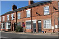
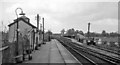
The lifestyle in LE9 6WG is shaped by its proximity to essential amenities. Within a short distance, residents can access five retail outlets, including Spar Broughton, Aldi Broughton, and Co-op Broughton, ensuring everyday shopping needs are met without long trips. The South Wigston Railway Station provides direct access to regional transport networks, making it easier to reach larger towns or cities for work, leisure, or services. While the area lacks large parks or entertainment venues, its small-scale retail options and rail connectivity contribute to a practical, low-stress lifestyle. The presence of two primary schools also supports family life, reducing the need for long commutes. Overall, the area offers a mix of convenience and simplicity, with amenities focused on daily essentials rather than expansive leisure facilities. This makes it ideal for those prioritising accessibility and a straightforward, community-oriented way of living.
Amenities
Schools
Residents of LE9 6WG have access to two primary schools within practical reach. Hallbrook Primary School Broughton Astley serves the area, while Hallbrook Primary School, also nearby, holds an Ofsted rating of satisfactory. The presence of two primary schools provides families with options, though the second school’s rating indicates room for improvement in educational standards. Both institutions cater to younger children, ensuring that parents can plan for their children’s early education without long commutes. The availability of local schooling is a key advantage for families, reducing the need for private education or travel to distant schools. However, the lack of secondary school options within the area may require residents to consider nearby towns for further education. Overall, the school provision supports a family-friendly environment, though the quality of one institution suggests that prospective buyers should investigate further if schooling is a priority.
| Rank | School | Type | Entry gender | Ages |
|---|
Explore more schools in this area
Go to Schools tabDemographics
The community in LE9 6WG is defined by its mature demographic, with a median age of 47 and the majority of residents falling within the 30–64 age range. This suggests a population largely composed of working-age adults and older households, with fewer young families or retirees compared to other areas. Home ownership is high at 77%, indicating a preference for long-term residency over rental properties. The accommodation type is predominantly houses, which aligns with the area’s residential character and likely contributes to a more private, spaced-out living environment. The predominant ethnic group is White, reflecting the broader demographic trends in the region. While no specific data on deprivation is provided, the high home ownership and low crime risk imply a relatively stable quality of life, with residents likely prioritising security and established living conditions over rapid change or investment-driven growth.
Household Size
Accommodation Type
Tenure
Ethnic Group
Religion
Household Composition
Age
Household Deprivation
NS-SEC
Explore more demographic insights in this area
Go to Demographics tabPlanning
Planning Constraints
- Flood RiskPremium
- Ramsar Wetland SitesPremium
- Area of Outstanding Natural BeautyPremium
- Protected Nature ReservePremium
- Protected WoodlandPremium