Area Overview for LE9 6TB
Photos of LE9 6TB
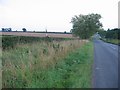
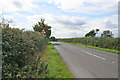
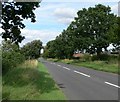
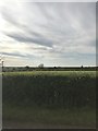
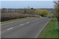
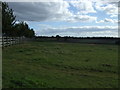
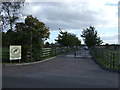
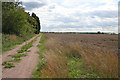
10 photos from this area
Area Information
Key information about the LE9 6TB including its size, population, and administrative classification.
- Area Type
- Postcode
- Area Size
- 1.8 hectares
- Population
- 1672
- Population Density
- 1172 people/km²
House Prices in LE9 6TB
57
Properties
£283,223
Average Sold Price
£177,600
Lowest Price
£597,495
Highest Price
Showing 57 properties
| Address | Type | Beds | Baths | Last Sale Price | Last Sale Date | |
|---|---|---|---|---|---|---|
| 10 Buxton Crescent, Broughton Astley, LE9 6TB | Detached | 3 | 2 | £305,000 | Nov 2025 | |
| 70 Buxton Crescent, Broughton Astley, LE9 6TB | Detached | 3 | 2 | £320,000 | Jun 2025 | |
| 40 Buxton Crescent, Broughton Astley, LE9 6TB | Detached | 3 | - | £330,000 | Mar 2025 | |
| 84 Buxton Crescent, Broughton Astley, LE9 6TB | Detached | 3 | 3 | £316,000 | Mar 2025 | |
| 102 Buxton Crescent, Broughton Astley, LE9 6TB | Detached | 3 | 3 | £305,000 | Feb 2025 | |
| 90 Buxton Crescent, Broughton Astley, LE9 6TB | house | - | - | £249,000 | Aug 2024 | |
| 100 Buxton Crescent, Broughton Astley, LE9 6TB | Semi-detached | 2 | 1 | £215,000 | Dec 2023 | |
| 64C Buxton Crescent, Broughton Astley, LE9 6TB | Terraced | 2 | 2 | £225,000 | Jan 2023 | |
| 32 Buxton Crescent, Broughton Astley, LE9 6TB | Retail | 4 | 2 | £380,000 | Sep 2022 | |
| 20 Buxton Crescent, Broughton Astley, LE9 6TB | house | - | - | £305,000 | Aug 2022 |
Page 1 of 6
Energy Efficiency in LE9 6TB
Amenities
Schools
| Rank | School | Type | Entry gender | Ages |
|---|
Explore more schools in this area
Go to Schools tabDemographics
Household Size
Two person
most common
Accommodation Type
Houses
most common
Tenure
87
majority
Ethnic Group
White
most common
Religion
N/A
most common
Household Composition
N/A
most common
Age
47
median
Adults (30-64 years)
most common
Household Deprivation
N/A
with no deprivation
NS-SEC
45
in Lower managerial occupations
Explore more demographic insights in this area
Go to Demographics tabPlanning
Planning Constraints
- Flood RiskPremium
- Ramsar Wetland SitesPremium
- Area of Outstanding Natural BeautyPremium
- Protected Nature ReservePremium
- Protected WoodlandPremium